
Free USA county map downloads
Utah County Map — Free Vector PDF
County boundaries, highways, towns and cities. Ready to download.
Get a ready-made Utah map, or colour your own counties online. Add place names and dots, or combine touching states into one county map.
Make the map your own
Turn counties into your own territories
Choose a colour, click the counties you cover and add a key. Build a clear picture of sales territories, service areas or regional teams in our online map colouring tool.
- Colour individual counties or groups of areas
- Add your own map title and colour key
- Try your map before buying access
Opens the Utah county map directly. Map access is needed to save and download your finished map.
Just want the ready-made map? Download the free PDF ↓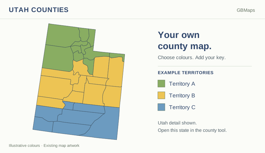
The free download
Utah County Map
A vector PDF with county outlines, main highways, towns and cities.
 View larger
 Your free PDF is ready
Use this ready-made map for a regional overview, a planning discussion or a printed reference. The vector artwork stays clear as you zoom in.
Download FREE Utah PDFPDF · County boundaries, roads and places · No account needed
Please retain the GBMaps copyright notice and check our map usage and copyright terms before publishing or redistributing artwork.
Need the editable artwork?
Get the supplied map files for design work. Available formats include PNG, PostScript, PowerPoint, SVG, EPS, PDF, Illustrator and JPG. Check the included files, current price and licence before buying.
View Utah map files & price →This is an artwork-file bundle, not access to the online colouring tool.
Or view the full-USA county artwork bundle →County territories across state lines
Build a multi-state county map
Choose up to three touching states on the USA chooser map. Load them together, colour the counties and use one title and key. Alaska can be added as a separate inset.
Choose states to combine →Try before buying. One state is £25 + VAT; buy selected states together, or unlock all 50 state county maps for £150 + VAT for 12 months. County access and ZIP-map access are separate products.
Places and county names
Show or hide county names, cities, towns and villages in Map details. Place names and dots are kept together and automatically thinned out where space is tight. Choose their colours to suit your map.
The new online state maps use Census 2025 county and equivalent boundaries. Connecticut uses its nine planning regions. The ready-made free artwork retains its original boundaries, as explained below.
Choose the right level of detail
Mapping Utah by county
Utah’s county map gives a regional overview of the Wasatch Front, northern communities and the southern part of the state. County coverage is a useful way to allocate responsibility, but it cannot by itself describe journeys through mountain and desert landscapes.
San Juan County and Tooele County are among Utah’s largest county-level areas by land area in the 2025 Census Gazetteer. A county-wide allocation can therefore be much broader than a local customer patch. Add town and city names to give your county territories local context.
- Counties
- 29US Census Bureau, 2025 Gazetteer
- Estimated residents
- 3,538,904US Census Bureau, 1 July 2025
- Square miles of land
- 82,376.85US Census Bureau, 2020 measurement
- Mapped 5-digit ZIP areas
- 224Areas in our separate ZIP colouring map
| What you want to do | Best place to start |
|---|---|
| Download a ready-made county and road map | Free county PDF |
| Edit the map in a design package | Utah artwork bundle |
| Colour counties and add my own key | Utah county colouring tool |
| Combine counties across state lines | Choose touching states |
Utah county names and reference list
Alphabetical reference list from the 2025 Gazetteer. Names and boundaries in older artwork may differ; this list is not a claim that the original map has been redrawn. Source: US Census Bureau, 2025 Gazetteer.
- Beaver County
- Box Elder County
- Cache County
- Carbon County
- Daggett County
- Davis County
- Duchesne County
- Emery County
- Garfield County
- Grand County
- Iron County
- Juab County
- Kane County
- Millard County
- Morgan County
- Piute County
- Rich County
- Salt Lake County
- San Juan County
- Sanpete County
- Sevier County
- Summit County
- Tooele County
- Uintah County
- Utah County
- Wasatch County
- Washington County
- Wayne County
- Weber County
Utah county map questions
How do I download the free Utah county map?
Use the green Download FREE PDF button on this page. No colouring-tool account is needed. The vector PDF includes county outlines, main highways, towns and cities. You can enlarge the preview first to check the detail.
How many counties does Utah have?
Utah has 29 counties in the 2025 Census Gazetteer. The alphabetical reference list below uses that source, not a new survey of the boundaries in the older map artwork. County, city and ZIP boundaries are different geographies.
Can I colour the counties and add my own key?
Yes. Open this state’s county colouring tool, choose a colour and click the counties you want to include. Add your own title and colour key to explain your sales territories, service coverage or other groups. The link opens this state on its own. You can also combine up to three touching states, with Alaska as the separate-inset exception.
Can I try the colouring tool before buying?
Yes. Load the county map and try colouring it and adding a key before buying access. Saving and downloading your finished map require the relevant map access. The free PDF on this page is a separate ready-made download.
Is the free PDF the same as the editable artwork bundle?
No. The free PDF is a ready-made vector map. The map-files purchase supplies a bundle of artwork formats for design work; follow the map-files link to check the included formats, current price and licence. Buying artwork files is separate from buying access to the online colouring tool.
What does access to the county maps cost?
One state costs £25 + VAT for 12 months. Buy your selected states together, or choose all 50 state county maps for £150 + VAT. Existing state access is excluded from the selected-state price. You can load and customise maps in trial mode before buying.
Can I use these maps for navigation or legal boundary checks?
No. These are visual reference and planning maps, not navigation, surveying or legal boundary records. A copyright year does not identify the date of the underlying boundaries. Check an authoritative source for decisions that depend on an exact boundary, or ask GBMaps about a particular area.
Need a hand? Read the map colouring help or talk to GBMaps.
Your counties. Your colours. Your map.
Show the areas that matter to your business.
Page content checked 1 October 2026 · About GBMaps · Facts are linked to their sources above.