Editable UK County Boundary Maps including Northern and Republic of Ireland County Maps. Colour your own UK Councils Maps Online.

Call Us Now for Help

01751 473136

Try our UK County Map Customisation Tools before you buy our Editable County Map Files

Our Vector Editable UK County Maps of the UK are highly detailed editable maps for use with something like Adobe Illustrator or Inkscape. Great for graphic designers but only if you know your way around those graphics packages.  We’ve created a simple online tool that enables everyone to create, customize and colour a UK County map into Zones or Territories and save the result as a vector editable adobe acrobat pdf file. Create as many maps as you want for a small one-off fee.

You can try our fully functional mapping tools without giving up your privacy.

No Signup
No Email Address
No Credit Card
No Privacy Concerns
No Stress

FREE UK County Boundaries Map as a PDF File Download

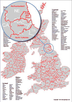
How many counties are there in the UK - 96 UK County Boundaries divide the UK. Download a UK County Boundary Map for free. Our maps show all the counties as separate editable labelled shapes which can be coloured individually. The labels can also be edited and coloured separately.

File types included with download.

pdf postcode map formathi resolution jpg postcode map
Free UK County Map Download
FREE UK County Boundaries Map
Free Postcode Map Download

1. Editable UK County Boundaries and Towns Map

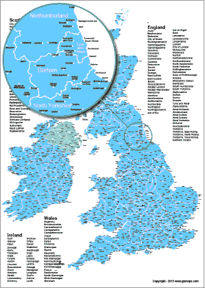
UK County Boundaries including towns and cities.Northern and Southern Ireland are included. All the counties of the UK are shown as individually layered shapes. 1344 Towns and cities across the UK are also displayed on the map in their own layers. You can show, hide or edit any of the layers on this map.

File types included with download.

Illustrator File Format Iconpdf postcode map formatphotoshop file format iconmicrosoft powerpoint postcode map file formatmap available as scalable vector graphics file format svg fileeps file format postcode maphi resolution jpg postcode map
Buy Files Now - £10.00
UK Ireland County Boundaries Map with Towns
County Boundary & Towns Details

3. Postcode Areas, Districts & County Boundaries Map

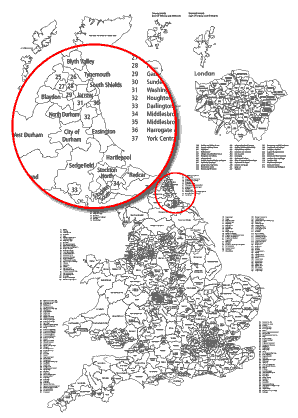
This map is fully editable using a vector editing software package. Showing all the postcode areas and districts along with County boundaries and county names as labels. This is quite a complicated map but easily editable with software such as Adobe Illustrator or Inkscape. Whole of UK is covered.

File types included with download.
Illustrator File Format Iconpdf postcode map formatmap available as scalable vector graphics file format svg fileeps file format postcode maphi resolution jpg postcode map
Buy Files Now - £45.00
Postcode Sector, District, Area Map
Postcode Area,District,Counties

4. UK Parliamentary Constituencies Map

This is a vector based map which is editable in Adobe Illustrator and printable from Acrobat. Split into 650 individual editable vector shapes this map can be customised and coloured as you wish. All labels can be edited and either shown or hidden and other information can be added if required.

File types included with download.

Illustrator File Format Iconpdf postcode map formatphotoshop file format iconmap available as scalable vector graphics file format svg fileeps file format postcode maphi resolution jpg postcode map
Buy Files Now - £15.00
UK Parliamentary Constituencies Map with Towns
Parlimentary Boundaries Maps