 LINCOLN · 01 · VIEW MAP ⤢
Full-colour street maps
Detailed roads, buildings and green spaces, styled for your project.
Bespoke city and street maps. Editable vector artwork, corporate colours and custom printed wall maps.
Custom City & Street Maps
Call Us Now for Help01751 473136Welcome back
Access your saved maps and downloads.
Need help accessing your account? Contact GBMaps.
UK CITY & STREET MAP DESIGN
Bespoke street maps, from a single neighbourhood to an entire city.
Created for your brand, your space and the way you’ll use them. Choose editable vector artwork, a printed wall map, or both.
Let’s talk about your map 01751 473136 © www.gbmaps.com
Use plus and minus to zoom, then drag the map to explore. With the map focused, use plus, minus and the arrow keys. Home resets the view.
NEED A MAP TODAY?
Free previews and larger downloads for UK cities, towns and villages.
BUILT AROUND YOUR BRIEF
A clear business location map, a whole-city plan or a series of matching maps. We choose the coverage and detail to suit the finished size.
LINCOLN · 01 · VIEW MAP ⤢Detailed roads, buildings and green spaces, styled for your project.
 LINCOLN · 02 · VIEW MAP ⤢
A focused colour palette for brochures, reports and company websites.
 LINCOLN · 03 · VIEW MAP ⤢
Amber roads, warm building colours and green spaces, tailored to your project.
 LINCOLN · 04 · VIEW MAP ⤢
Monochrome artwork for directions, publications and consistent map series.
SHARP AT EVERY SCALE
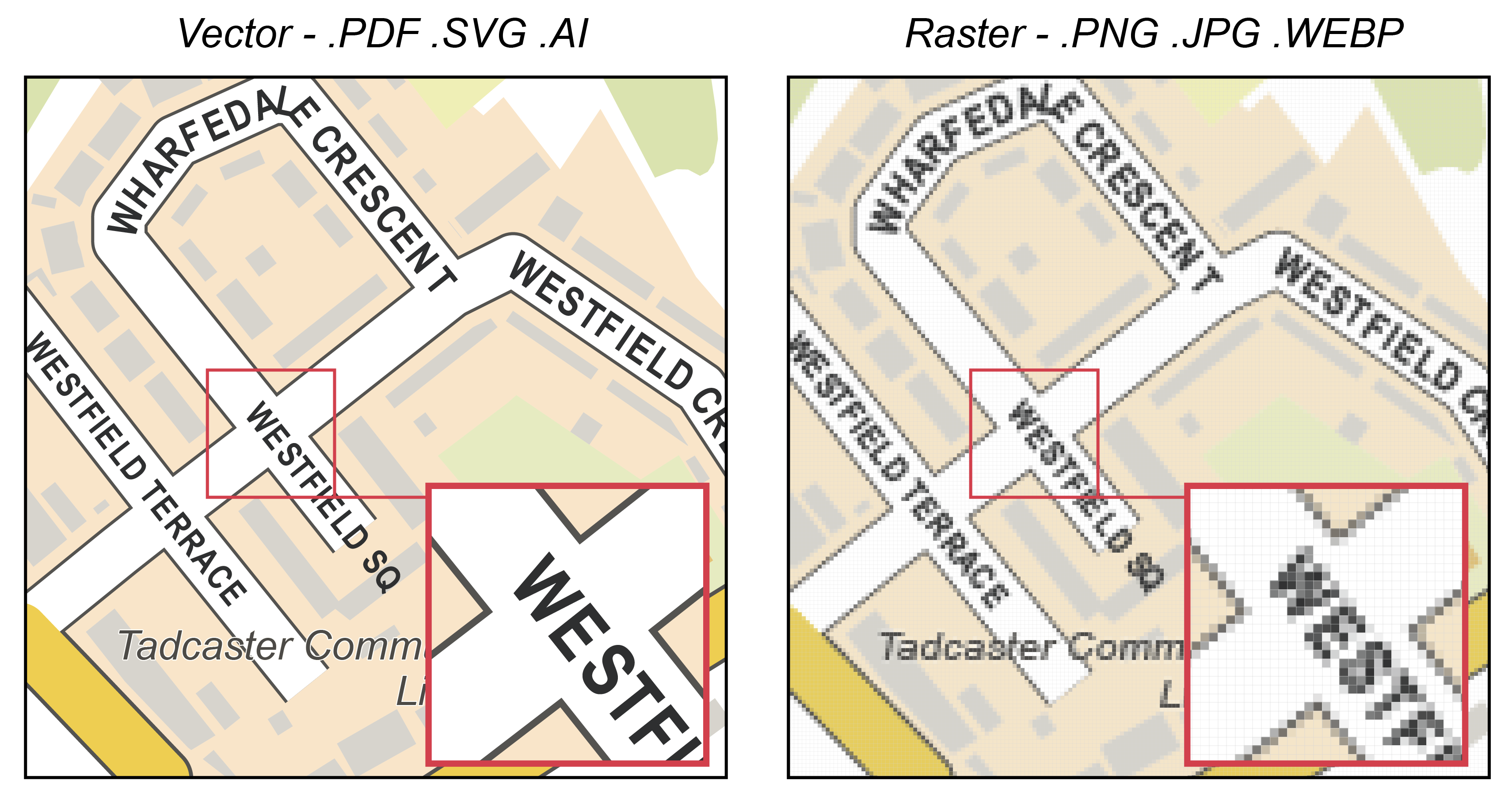
Enlarge a vector map and the roads, shapes and lettering stay sharp. Recolour it, edit it and reuse it across print and digital projects.
A raster image is made of pixels. It can look excellent at the right resolution, but enlarging a small PNG or JPG exposes those pixels.
MADE FOR DESIGNERS TO WORK WITH
A map you can work on, not one flattened picture.
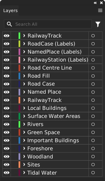
Our Illustrator artwork is usually supplied with named layers, so you can select the feature you need without disturbing the rest of the map. We agree the structure and editable text requirements with you.


Native Illustrator layers, SVG, vector PDF or EPS, plus image and presentation exports as required. Tell us which software you use; file formats and layer support vary.
FROM ARTWORK TO SOMETHING TANGIBLE
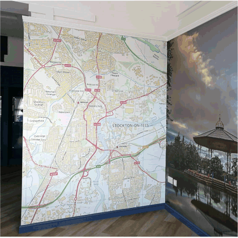
A city-wide feature wall for a company reception. A practical office planning map. A branded map for a visitor guide.
We work with a small, trusted circle of commercial print suppliers to arrange everything from standard sheets to large, multi-panel installations. Tell us the surface, dimensions and purpose; we’ll help find a suitable production route.
A3, A2, A1, A0 or bespoke dimensions. Large maps are planned around material limits, panel joins and readable detail.
Tell us what you have in mind More about map printing ↗A CLEAR ROUTE TO YOUR MAP
Coverage, intended use, dimensions, colours and any information to add.
We confirm the scope, files, print options, timing and quote before starting.
Check the artwork, then receive the agreed digital files or arrange the print.
LET’S MAKE YOUR MAP
You don’t need a finished specification. Tell us what you’re trying to achieve and we’ll help turn it into a clear brief.
01751 473136Email Andrew at GBMapsUseful details: a place or postcode, a rough boundary, finished dimensions, your deadline and any brand guidelines.
We can create custom coverage for UK cities, towns and villages, including neighbourhoods and surrounding areas. We’ll confirm the available detail and data for your chosen area before quoting.
Yes. Supply your colour palette, fonts and logo guidelines. We can style roads, water, green space and labels to fit, while keeping the map readable.
We can supply layered Adobe Illustrator artwork and other vector formats. We agree the required layers, text treatment and software compatibility as part of the brief. SVG groups and PDF structure are not identical to native Illustrator layers.
Vector artwork can be scaled without pixelation. The practical print size depends on the material, available equipment and whether the map is split into panels. We also design the labels and level of detail for the viewing distance.
Yes. Postcode overlays, branches, delivery zones, routes and custom boundaries can be included, subject to the data available and any relevant licensing. We’ll agree the content and permissions before production.
Search our city, town and village maps for a free preview and larger downloadable files. Check the coverage on the individual map page before choosing a download.
London example: cartography © GBMaps. Contains OS, Royal Mail and National Statistics data © their respective rights holders 2026; map data © OpenStreetMap contributors. Examples illustrate available styles; coverage, layers, formats and usage are agreed for each project. Map copyright & usage.