UK county maps for England, Scotland and Wales · PDF downloads and online map colouring

GBMAPS.COM

UK County Maps

Call Us Now for Help01751 473136

ENGLAND · SCOTLAND · WALES

UK county maps — free PDF downloads

Find a county map, download a UK county boundary PDF or colour your own map online. Start with one county, or see England, Scotland and Wales together.

Download free county map PDF

No email or account needed. Keep the map credits when sharing or printing.

© GBMaps.com · Keep the copyright and source credits with the map. The overview excludes Shetland; its individual map is in the county list.

THE WHOLE PICTURE

Download a free UK county map

A county boundary overview for reference, planning and presentations.

See how the counties fit together across England, Scotland and Wales. Use the overview when you need the wider picture; choose an individual county below when you need to focus on one area.

  • Named counties, bold regional colours and a printable A3 PDF.
  • Free to download immediately. No email address or account needed.
  • No account needed. Use under the GBMaps licensing terms; retain the copyright credits.
UK county boundary PDF · A3England, Scotland and Wales
FREE
Get the free county map PDF

Need editable counties or your own colour scheme? Try the online county map colouring tool.

YOUR COUNTY, IN DETAIL

Choose your individual county map

91 county maps

Browse the county maps of England, Scotland and Wales. Each name takes you straight to its map page.

County colouring tool: South East, East of England and London grouped into coloured regions.

MAKE THE MAP YOUR OWN

Colour your own UK county map

Turn a county boundary map into sales territories, delivery zones or a regional report. Choose your own colours and labels in your browser, without desktop illustration software.

  • Give counties or postcode areas your own colours.
  • Add place markers, labels and a map key.
  • Create territory maps, heat maps and thematic maps.
Open the county map colouring tool ↗

Try the editor on a PC, Mac, tablet or phone. Saving and export options are shown in the tool.

LOOK A LITTLE CLOSER

Maps for individual counties

Explore one county at a time, from its main towns to its smaller places. The new county-map design brings together map previews, a central PDF sample, postcode information and useful facts about the area.

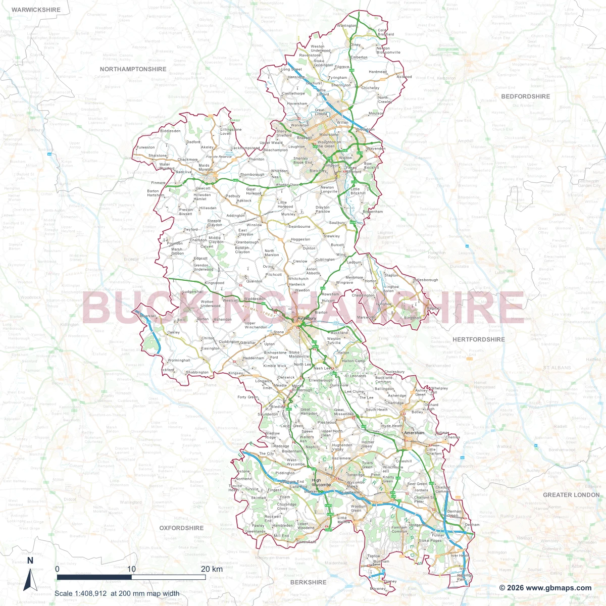
Explore the Buckinghamshire county map
Buckinghamshire county map with its boundary highlighted and surrounding areas faded.

CHOOSE THE RIGHT MAP

County boundaries, downloads and editing

For a county reference map

Download the UK overview to show counties together, or browse the individual county pages for a specific place. County boundaries do not follow postcode districts, so pick the map that matches your task.

Browse the county map collection

For sales territories and zones

Colour counties, combine them into regions and add your own labels in the online editor. It is a useful starting point for sales areas, service coverage, heat maps and delivery zones.

Edit a UK county map online

About the free UK county maps

How do I download the free county map PDF?

Choose “Download free county map PDF” for an immediate download. No email, account or payment is needed. You can request occasional GBMaps emails separately if you wish.

Does the county map include Northern Ireland?

The overview and the 91 county pages in this collection cover England, Scotland and Wales, together known as Great Britain. They do not include Northern Ireland. Contact GBMaps if you need a different boundary collection.

Are these the same as local authority boundaries?

Not always. The county collection includes established county outlines, which can differ from current council areas. For councils and districts, explore our local authority boundary maps. Check the chosen map’s outline before using it to define an administrative area.

Can I edit and colour a county map without Illustrator?

Yes. Use the county map colouring tool in a modern browser to set colours and add labels. The tool explains its save and export options. A PDF viewer is for viewing and printing; detailed vector editing needs suitable software and experience.

Can I print the maps or use them on a website?

Keep the GBMaps copyright notice and any source credits on the map. Read the map usage and licensing terms for your intended use. Contact us before resale, public redistribution of the source files, or using the maps in products you sell.

Where is the existing county overview PDF?

The established PDF address still opens a free PDF. Use the download button for the current overview PDF, with no email signup needed.

Digital download available immediately after payment is confirmed, with no delivery charge. Please check the free preview before buying: downloaded digital products cannot be returned. Delivery and returns policy.

GBMAPS.COM OPTIONAL EMAIL UPDATES
PDF filePDF

Occasional GBMaps emails

England, Scotland & Wales · PDF download · No charge

Your PDF is free without signing up. If you would like occasional GBMaps emails, enter your address and confirm the choice below.

You can unsubscribe at any time. Privacy policy

We won’t sell your details or let other businesses use them for marketing.

Keep the copyright credits. Read our copyright and map usage terms before publishing, redistributing or adapting a map.

UK county boundary map

Great Britain county overview with regional colours and white county boundaries; Shetland is not shown.

© GBMaps.com · Use under the GBMaps licensing terms. Retain the copyright and source credits.

Get the free county map PDF
Get your Great Britain county overview map

Map download bundle

£15.00including VATOne payment

Pay securely

Keep the copyright credits. Read our copyright and map usage terms before publishing, redistributing or adapting a map.

One payment. Your map stays open.

Your map download

Your map files

Preparing your download…

Checking your private download link…

Your map downloads

Already bought a map?

Find the downloads from your purchases.

Enter the email address you used at checkout. We’ll email you a private link to your available map downloads.