Static Caravan Park Maps
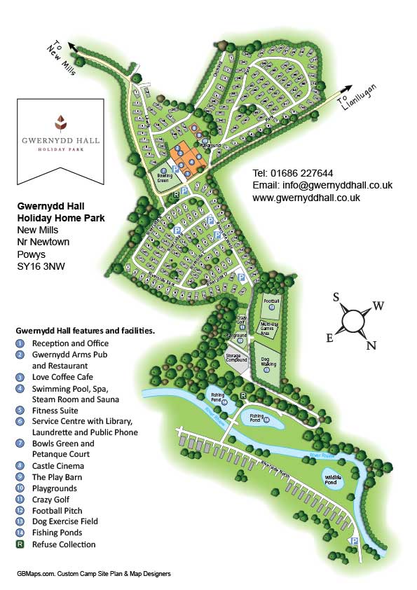
Gwernydd Hall Holiday Park is a five-star holiday home park in the magical heartland of Mid Wales. Set back in the hills between the pretty market town of Welshpool and bustling Newtown, the park is an oasis of calm and tranquillity, but still within easy reach of the Midlands. Set in over 45 acres, in an area of contrasting and beautiful landscape. Gwernydd Hall wanted an attractive and meaningful plan of all their properties along with all the facilities of the park mapping on an easy to read plan.

Click on the map to enlarge
Holiday Park and Activity Centre Maps
Phasels Wood Activity Centre is a place where young people will find inspiration, adventure, challenges and friendship, all within a safe, supportive and positive environment. Owned and run by Hertfordshire Scouts, made up of 95 acres of meadow, woodland and large fields, it nestles in the Hertfordshire countryside, surrounded by fields and country lanes, serenely belying the fact that it is on the edge of bustling Hemel Hempstead with Watford just five miles away.

Click on the map to enlarge
Football Golf Course Map
This simple 3D Football Golf Course map was required by a company who previously had one of our Golf Course Maps. Diversifying from purely golf to include footy-golf thy required a new course map to be incorporated into their scorecard. Being only A6 in size this footy golf course map had to be designed with simplicity and readability in mind. The score cards doubled up as advertising cards which could be taken away and used by people to help plan their days out when on holiday in the area.

Click on the map to enlarge
3D Leisure Park Maps and Plans
Set in an area that is well known for its historic and natural beauty,Happy Days is ideal for exploring the fantastic beaches, valleys and mountain ranges of North Wales. With three parks being around 500 yards from each other they offer a wide range of facilities and are right by the seaside so you have easy access to the beach. Our leisure park map helped increase awareness of the location of all facilities on the site.

Click on the map to enlarge
Holiday Caravan and Campsite Plans
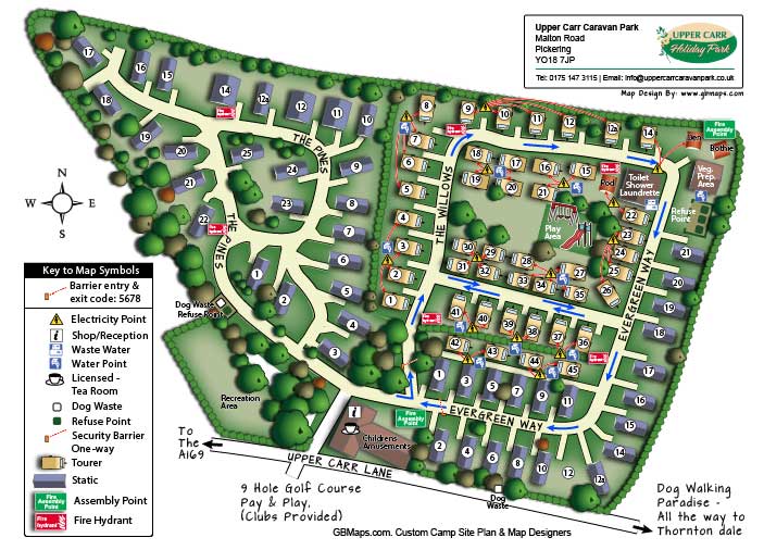
Upper Carr Caravan Park Map. Being a relatively new park there were no existing aerial photographs or plans to work from when we did this map. We travelled to the site and flew our one man foot launched backpack aircraft called a paramotor over the site to take our own aerial photographs. From this we were able to produce a truly acurate and up to date Caravan Park Map for the customer. The results speak for themselves.

Click on the map to enlarge
Download PDF sample camp site, leisure park and holiday park maps and plans from the holidayparkmaps.com website. See how little a bespoke park map will cost for your site by clicking on the logo above.
Golf Course Maps and Site Plans
Golf courses usually have maps on their score cards but they are never really any use. Too small, black and white or out of date they cause more problems than anything else. Our maps are simple, colourful and effective at giving the golfer a clear understanding of the features of the course and enabling them to navigate the course without getting lost in the rough. We can photograph the course from the air in order to get accurate images to work from.

Click on the map to enlarge
Call or message us today to talk about your town or city map project. Tel 01751 473136 or Contact Form
