FREE NORTHAMPTON POSTCODE SECTOR MAP
NN – Northampton Postcode Sector Map 80 mapped sectors · NN1 1 to NN29 7
Explore the 80 mapped postcode sectors in the NN postcode area. The map labels sectors; the directory highlights those with distinct sector-matched places and localities.
Download the Northampton postcode sector map
Orange sector artwork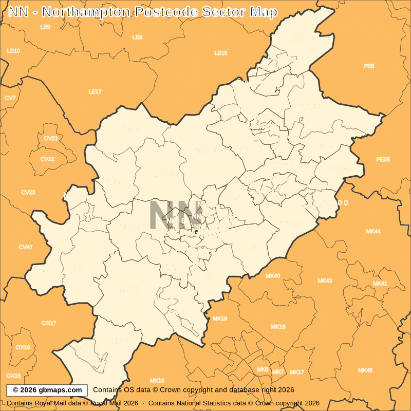
Free editable vector postcode map downloads
Also available as free postcode map images

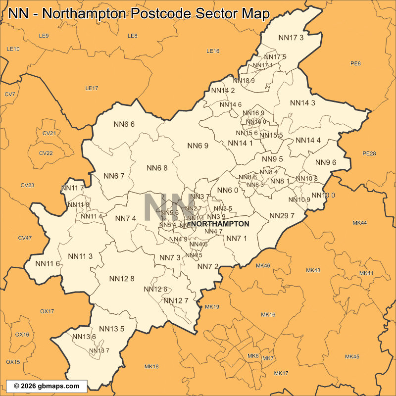
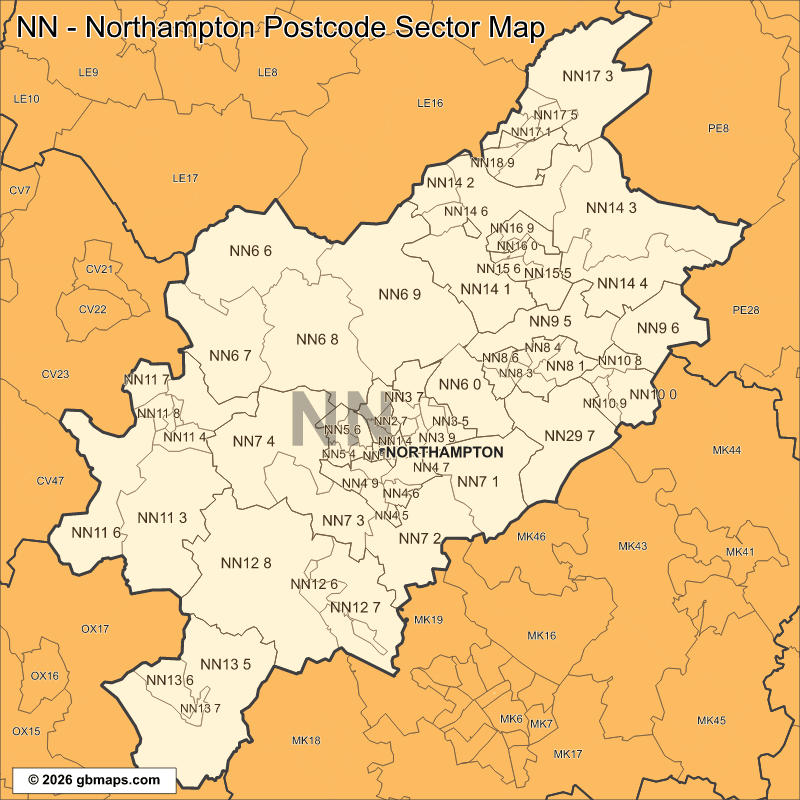
PDF and SVG remain sharp at any size. PNG, JPG and GIF are 800-pixel images. Check the map credits before reuse.

POSTCODE SECTOR COLOURING TOOL
Make your own Northampton sector map
See NN postcode sectors divided into 4 example territories, then use the online colouring tool to build a map for your sales or delivery areas.
Open the sector map colouring toolNN POSTCODE SECTORS AND PLACES
NN postcode sector directory
These 49 sectors each introduce at least one named place or locality not already shown in this directory. The complete map contains 80 sectors. Names are matched to sectors and grouped by shared outward code.
| Sector | Local places |
|---|---|
| NN1 postcode sectors | |
| NN1 1 | Northampton |
| NN2 postcode sectors | |
| NN2 7 | Kingsthorpe |
| NN2 8 | Boughton |
| NN3 postcode sectors | |
| NN3 7 | Moulton |
| NN3 9 | Billing |
| NN4 postcode sectors | |
| NN4 0 | Collingtree |
| NN4 5 | Grange Park |
| NN4 6 | Hardingstone, Wootton |
| NN4 7 | Brackmills, Great Houghton |
| NN4 8 | Far Cotton |
| NN5 postcode sectors | |
| NN5 6 | Duston, New Duston |
| NN6 postcode sectors | |
| NN6 0 | Earls Barton, Ecton, Mears Ashby, Overstone, Sywell |
| NN6 6 | Yelvertoft, Claycoton, Cold Ashby, Naseby, Stanford On Avon, Welford |
| NN6 7 | Long Buckby, Crick, Long Buckby Wharf, Watford, West Haddon, Winwick |
| NN6 8 | Spratton, Chapel Brampton, Church Brampton, Coton, Cottesbrooke, Creaton |
| NN6 9 | Brixworth, Draughton, Hanging Houghton, Hannington, Harrington, Haselbech |
| NN7 postcode sectors | |
| NN7 1 | Cogenhoe, Brafield-On-The-Green, Castle Ashby, Denton, Grendon, Little Houghton |
| NN7 2 | Roade, Ashton, Courteenhall, Hackleton, Hartwell, Horton |
| NN7 3 | Bugbrooke, Blisworth, Gayton, Milton Malsor, Nether Heyford, Rothersthorpe |
| NN7 4 | Weedon Bec, Brockhall, Church Stowe, Dodford, Flore, Great Brington |
| NN8 postcode sectors | |
| NN8 1 | Wellingborough |
| NN8 2 | Wilby |
| NN9 postcode sectors | |
| NN9 5 | Irthlingborough, Finedon, Great Harrowden, Hardwick, Little Harrowden |
| NN9 6 | Raunds, Caldecott, Chelveston, Stanwick |
| Sector | Local places |
|---|---|
| NN10 postcode sectors | |
| NN10 0 | Rushden, Newton Bromswold |
| NN10 8 | Higham Ferrers |
| NN10 9 | Little Wymington, Wymington |
| NN11 postcode sectors | |
| NN11 0 | Daventry |
| NN11 2 | Welton, Norton, Whilton |
| NN11 3 | Hinton, Badby, Canons Ashby, Charwelton, Everdon, Eydon |
| NN11 6 | Byfield, Aston Le Walls, Catesby, Hellidon, Lower Boddington, Staverton |
| NN11 7 | Braunston |
| NN12 postcode sectors | |
| NN12 6 | Towcester, Potterspury |
| NN12 7 | Alderton, Grafton Regis, Hulcote, Paulerspury, Pury End |
| NN12 8 | Silverstone, Abthorpe, Adstone, Astcote, Blakesley, Bradden |
| NN13 postcode sectors | |
| NN13 5 | Syresham, Biddlesden, Turweston, Westbury, Croughton, Crowfield |
| NN13 6 | Brackley, Halse |
| NN14 postcode sectors | |
| NN14 1 | Broughton, Geddington, Great Cransley, Isham, Loddington, Newton |
| NN14 2 | Desborough |
| NN14 3 | Brigstock, Aldwincle, Clopton, Grafton Underwood, Islip, Lowick |
| NN14 4 | Thrapston, Cranford St Andrew, Cranford St John, Denford, Great Addington, Little Addington |
| NN14 6 | Rothwell |
| NN15 postcode sectors | |
| NN15 5 | Burton Latimer |
| NN15 6 | Kettering, Barton Seagrave |
| NN16 postcode sectors | |
| NN16 9 | Warkton, Weekley |
| NN17 postcode sectors | |
| NN17 1 | Corby |
| NN17 3 | Weldon, Bulwick, Deene, Deenethorpe, Gretton, Harringworth |
| NN18 postcode sectors | |
| NN18 8 | Great Oakley, Little Oakley |
| NN29 postcode sectors | |
| NN29 7 | Wollaston, Farndish, Hinwick, Podington, Bozeat, Easton Maudit |
This is a place finder, not a list of every sector or address. A name appears once even when it spans several sectors. Use a current full postcode to check an address.
Looking for another postcode area?
Our maps are free for non-commercial use. Commercial use requires a licence for a small one-off charge. Please retain all supplied copyright notices. The GBMaps copyright notice must appear on the map itself in every format; vector maps (PDF and SVG) must also display the Ordnance Survey, Royal Mail and other supplied data acknowledgements. Email us about commercial use.