
ALSt AlbansPostcode sector map
AL1 1 to AL10 935 sectors
- Local places include
- St Albans, London Colney, How Wood, Smug Oak
South East postcode sector maps: 18 postcode areas and 1,436 mapped sectors, including Brighton, Portsmouth and Reading. Download a free PDF or a complete editable map bundle for £12 including VAT.
Welcome back
Access your saved maps and downloads.
Need help accessing your account? Contact GBMaps.
FREE SOUTH EAST POSTCODE SECTOR MAP DOWNLOADS
Explore 18 postcode area maps in this South East collection, covering 1,436 labelled sectors around Brighton, Portsmouth and Reading. Choose a map to see its sector boundaries, sector-matched places and a free PDF or a complete PDF, SVG, PNG, JPG and GIF bundle for £12 including VAT.
The overview shows postcode areas; the linked maps below show their sectors. Postcode areas may cross regional boundaries. This collection follows the established GBMaps site grouping.

FIND YOUR POSTCODE LETTERS
18 maps · 1436 mapped sectors
Open any map for the full-size preview, a free PDF and editable vector bundle and its postcode sector place directory.
AL1 1 to AL10 935 sectors

BN1 1 to BN45 7101 sectors

CM0 7 to CM77 881 sectors

CT1 1 to CT21 668 sectors
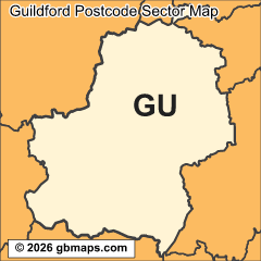
GU1 1 to GU52 9112 sectors

HP1 1 to HP27 961 sectors

LU1 1 to LU7 928 sectors

ME1 1 to ME20 772 sectors

MK1 1 to MK46 589 sectors

OX1 1 to OX49 5105 sectors

PO1 1 to PO41 0111 sectors

RG1 1 to RG45 7129 sectors

RH1 1 to RH20 469 sectors

SG1 1 to SG19 354 sectors

SL0 0 to SL9 949 sectors

SO14 0 to SO53 5108 sectors

SS0 0 to SS17 956 sectors

TN1 1 to TN40 2108 sectors
Ranges show the first and last sector on each map; intermediate sector codes need not be consecutive. Place examples come from sector-matched settlement data.

MAKE THESE SECTORS YOUR OWN
See the St Albans postcode sectors divided into four example territories, then try the online map tool for your own project.
Make your own South East postcode sector mapCHOOSE THE FORMAT THAT WORKS FOR YOU
Choose PDF or SVG on an area page for sharp sector boundaries and labels at any size. Open the file in compatible vector editing software to adapt the artwork.
Choose PNG, JPG or GIF for a 800-pixel map image. Each area page also highlights sectors with distinct sector-matched places and localities.
Our maps are free for non-commercial use. Commercial use requires a licence for a small one-off charge. Please retain all supplied copyright notices. The GBMaps copyright notice must appear on the map itself in every format; vector maps (PDF and SVG) must also display the Ordnance Survey, Royal Mail and other supplied data acknowledgements. Email us about commercial use.