Free Oxford PDF Map
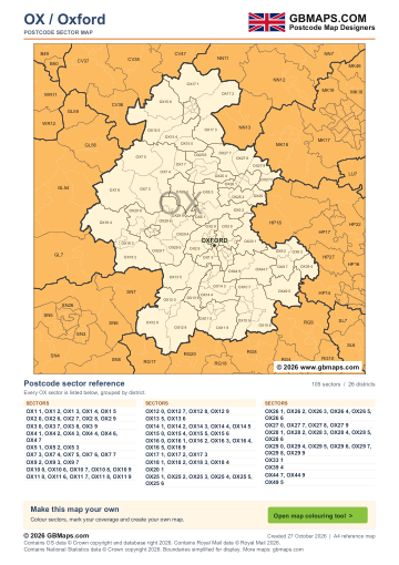
- Full OX postcode-area coverage
- PDF with GBMaps branding
- Includes a map colouring tool link
PDF
FreePDF download
For non-commercial use
Oxford postcode sector maps · Free PDF and complete map bundle
Welcome back
Access your saved maps and downloads.
Need help accessing your account? Contact GBMaps.
OXFORD POSTCODE SECTOR MAP DOWNLOADS
See the 105 postcode sector boundaries within the Oxford (OX) postcode area. Sectors divide districts into smaller areas for more detailed territory planning. Download the branded PDF free, or choose the complete bundle with a clean PDF, editable SVG and PNG, JPG and GIF images.
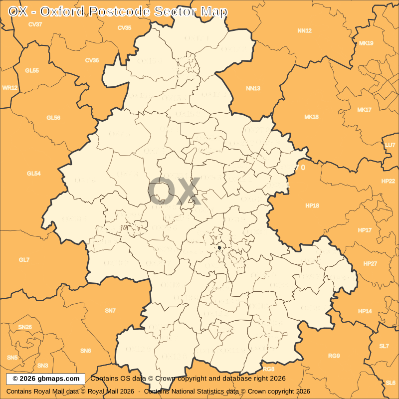
Explore the 105 mapped postcode sectors in the OX postcode area. Download the free Oxford postcode sector map as a PDF, or choose the complete map bundle with a clean PDF, editable SVG and PNG, JPG and GIF images.
FreePDF download
For non-commercial use

£12including VAT
£10 + £2 VAT · One-off payment
The free PDF needs no email, account or payment. The bundle includes all five formats in one ZIP. Required map-data copyright credits are retained in both versions.

POSTCODE SECTOR COLOURING TOOL
See OX postcode sectors divided into 4 example territories, then use the online colouring tool to build a map for your sales or delivery areas.
Open the sector map colouring toolOX POSTCODE SECTORS AND PLACES
These 77 sectors each introduce at least one named place or locality not already shown in this directory. The complete map contains 105 sectors. Names are matched to sectors and grouped by shared outward code.
| Sector | Local places |
|---|---|
| OX1 postcode sectors | |
| OX1 1 | Oxford |
| OX1 5 | Kennington, Boars Hill, Foxcombe Hill, Henwood, South Hinksey, Wootton |
| OX2 postcode sectors | |
| OX2 8 | Wolvercote, Wytham |
| OX2 9 | Botley, Cumnor, Farmoor |
| OX3 postcode sectors | |
| OX3 0 | Marston |
| OX3 9 | Beckley, Elsfield, Headington, Noke, Woodeaton |
| OX4 postcode sectors | |
| OX4 2 | Cowley |
| OX4 3 | Littlemore |
| OX4 4 | Sandford-On-Thames |
| OX5 postcode sectors | |
| OX5 1 | Kidlington, Begbroke, Shipton-On-Cherwell, Thrupp, Yarnton |
| OX5 2 | Charlton-On-Otmoor, Fencott, Hampton Poyle, Islip, Murcott |
| OX5 3 | Kirtlington, Bletchingdon, Northbrook, Tackley |
| OX7 postcode sectors | |
| OX7 3 | Charlbury, Chadlington, Chilson, Dean, Fawler, Finstock |
| OX7 4 | Enstone, Cleveley, Fulwell, Gagingwell, Great Tew, Little Tew |
| OX7 5 | Chipping Norton, Dunthrop, Great Rollright, Heythrop, Over Norton, Salford |
| OX7 6 | Milton Under Wychwood, Bledington, Church Westcote, Nether Westcote, Ascott-Under-Wychwood, Bruern Abbey |
| OX7 7 | Middle Barton, Ledwell, Nether Worton, Over Worton, Sandford St Martin, Westcott Barton |
| OX9 postcode sectors | |
| OX9 2 | Thame, Milton Common, Moreton, Tiddington |
| OX9 3 | Towersey |
| OX9 7 | Tetsworth, Adwell, Postcombe, South Weston, Stoke Talmage |
| OX10 postcode sectors | |
| OX10 0 | Wallingford, Brightwell-Cum-Sotwell |
| OX10 6 | Benson, Berrick Salome, Ewelme, Ipsden, North Stoke, Roke |
| OX10 7 | Berinsfield, Dorchester, Drayton St Leonard, Newington, Shillingford, Warborough |
| OX10 8 | Crowmarsh Gifford |
| OX10 9 | Cholsey, Moulsford |
| OX11 postcode sectors | |
| OX11 0 | Harwell, Chilton, West Hagbourne |
| OX11 7 | Didcot |
| OX11 9 | Blewbury, Aston Tirrold, Aston Upthorpe, East Hagbourne, North Moreton, South Moreton |
| OX12 postcode sectors | |
| OX12 0 | Grove, Charney Bassett, Denchworth, East Hanney, Lyford, West Hanney |
| OX12 7 | Wantage |
| OX12 8 | Ardington, East Ginge, East Hendred, Lockinge, West Ginge |
| OX12 9 | Childrey, East Challow, Kingston Lisle, Letcombe Bassett, Letcombe Regis |
| OX13 postcode sectors | |
| OX13 5 | Kingston Pagpuize, Appleton, Eaton, Fyfield, Garford, Kingston Bagpuize |
| OX13 6 | Steventon, Bayworth, Cothill, Dry Sandford, Frilford, Marcham |
| OX14 postcode sectors | |
| OX14 1 | Abingdon |
| OX14 3 | Burcot, Clifton Hampden, Radley |
| OX14 4 | Sutton Courtenay, Appleford, Culham, Drayton, Little Wittenham, Long Wittenham |
| OX14 5 | Abingdon-On-Thames |
| OX15 postcode sectors | |
| OX15 0 | Deddington, Barford St John, Barford St Michael, Clifton, Hempton |
| Sector | Local places |
|---|---|
| OX15 postcode sectors (continued) | |
| OX15 4 | Bloxham, Bodicote, Milcombe, Milton, South Newington, Wigginton |
| OX15 5 | Hook Norton, Broughton, Burdrop, Lower Tadmarton, Sibford Ferris, Sibford Gower |
| OX15 6 | Wroxton, Alkerton, Balscote, Epwell, Horley |
| OX16 postcode sectors | |
| OX16 0 | Banbury |
| OX17 postcode sectors | |
| OX17 1 | Cropredy, Chipping Warden, Edgcote, Claydon, Great Bourton, Hanwell |
| OX17 2 | Middleton Cheney, Chacombe, Culworth, Greatworth, Marston St Lawrence, Overthorpe |
| OX17 3 | Adderbury, Aynho, Charlton, Kings Sutton, Newbottle, Upper Astrop |
| OX18 postcode sectors | |
| OX18 1 | Carterton |
| OX18 2 | Bampton, Alvescot, Aston, Black Bourton, Chimney, Clanfield |
| OX18 3 | Brize Norton |
| OX18 4 | Burford, Great Barrington, Little Barrington, Windrush, Asthall, Bradwell Grove |
| OX20 postcode sectors | |
| OX20 1 | Woodstock, Bladon, Glympton, Kiddington, Over Kiddington |
| OX25 postcode sectors | |
| OX25 1 | Arncott, Blackthorn, Lower Arncott, Piddington, Upper Arncott |
| OX25 2 | Ambrosden, Merton, Wendlebury |
| OX25 3 | Weston-On-The-Green |
| OX25 4 | Steeple Aston, Caulcott, Middleton Stoney, Rousham, Steeple Barton |
| OX25 5 | Upper Heyford Airfield, Lower Heyford, Middle Aston, Upper Heyford |
| OX25 6 | Duns Tew, North Aston, Somerton |
| OX26 postcode sectors | |
| OX26 1 | Chesterton |
| OX26 2 | Bicester |
| OX26 5 | Launton |
| OX27 postcode sectors | |
| OX27 0 | Marsh Gibbon, Charndon |
| OX27 7 | Ardley, Baynard's Green, Bucknell, Fritwell, Souldern |
| OX27 8 | Bainton, Caversfield, Fringford, Hardwick, Hethe |
| OX27 9 | Stratton Audley, Poundon, Godington |
| OX28 postcode sectors | |
| OX28 1 | Witney |
| OX29 postcode sectors | |
| OX29 0 | Minster Lovell, Charterville Allotments |
| OX29 4 | Eynsham, Cassington, Swinford |
| OX29 5 | Stanton Harcourt, Northmoor, Sutton, West End |
| OX29 6 | North Leigh, Barnard Gate, Church End, East End, High Cogges, New Yatt |
| OX29 7 | Ducklington, Brighthampton, Curbridge, Shifford, Standlake |
| OX29 8 | Stonesfield, Church Hanborough, Combe, Freeland, Long Hanborough |
| OX29 9 | Hailey, Asthall Leigh, Crawley, Delly End, Fordwells, Leafield |
| OX33 postcode sectors | |
| OX33 1 | Wheatley, Forest Hill, Holton, Horspath, Horton-Cum-Studley, Stanton St John |
| OX39 postcode sectors | |
| OX39 4 | Chinnor, Crowell, Crowell Hill, Emmington, Henton, Kingston Blount |
| OX44 postcode sectors | |
| OX44 7 | Chalgrove, Chiselhampton, Great Haseley, Great Milton, Little Haseley, Little Milton |
| OX44 9 | Garsington, Cuddesdon, Denton, Marsh Baldon, Nuneham Courtenay, Toot Baldon |
| OX49 postcode sectors | |
| OX49 5 | Watlington, Aston Rowant, Brightwell Baldwin, Britwell Salome, Christmas Common, Cuxham |
This is a place finder, not a list of every sector or address. A name appears once even when it spans several sectors. Use a current full postcode to check an address.
The free PDF is for non-commercial use and includes GBMaps branding and a map colouring tool link. The paid bundle includes a commercial-use licence, without promotional watermarks or tool links. Required map-data and GBMaps copyright credits remain. Email us about commercial use Map licence terms · Digital delivery and returns.