
DHDurhamPostcode sector map
DH1 1 to DH9 940 sectors
- Local places include
- Durham, Pelton, Chester-Le-Street, Birtley
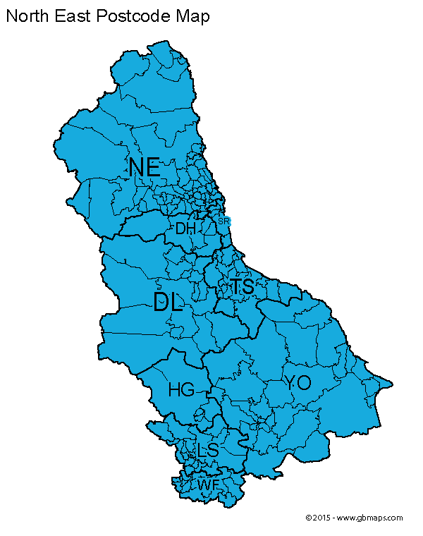
North East postcode sector maps: 10 postcode areas and 777 mapped sectors, including Newcastle upon Tyne, Durham and York. Download a free PDF or a complete editable map bundle for £12 including VAT.
Welcome back
Access your saved maps and downloads.
Need help accessing your account? Contact GBMaps.
FREE NORTH EAST POSTCODE SECTOR MAP DOWNLOADS
Explore 10 postcode area maps in this North East collection, covering 777 labelled sectors around Newcastle upon Tyne, Durham and York. Choose a map to see its sector boundaries, sector-matched places and a free PDF or a complete PDF, SVG, PNG, JPG and GIF bundle for £12 including VAT.
The overview shows postcode areas; the linked maps below show their sectors. HU has a sector map below but is not labelled on the overview. Postcode areas may cross regional boundaries. This collection follows the established GBMaps site grouping.
FIND YOUR POSTCODE LETTERS
10 maps · 777 mapped sectors
Open any map for the full-size preview, a free PDF and editable vector bundle and its postcode sector place directory.
DH1 1 to DH9 940 sectors

DL1 1 to DL17 959 sectors

HG1 1 to HG5 922 sectors

HU1 1 to HU20 360 sectors

LS1 2 to LS29 9116 sectors

NE1 1 to NE71 6183 sectors

SR1 1 to SR8 534 sectors

TS1 1 to TS29 693 sectors

WF1 1 to WF17 967 sectors

YO1 6 to YO62 7103 sectors
Ranges show the first and last sector on each map; intermediate sector codes need not be consecutive. Place examples come from sector-matched settlement data.

MAKE THESE SECTORS YOUR OWN
See the Durham postcode sectors divided into four example territories, then try the online map tool for your own project.
Make your own North East postcode sector mapCHOOSE THE FORMAT THAT WORKS FOR YOU
Choose PDF or SVG on an area page for sharp sector boundaries and labels at any size. Open the file in compatible vector editing software to adapt the artwork.
Choose PNG, JPG or GIF for a 800-pixel map image. Each area page also highlights sectors with distinct sector-matched places and localities.
Our maps are free for non-commercial use. Commercial use requires a licence for a small one-off charge. Please retain all supplied copyright notices. The GBMaps copyright notice must appear on the map itself in every format; vector maps (PDF and SVG) must also display the Ordnance Survey, Royal Mail and other supplied data acknowledgements. Email us about commercial use.