Free Hereford PDF Map
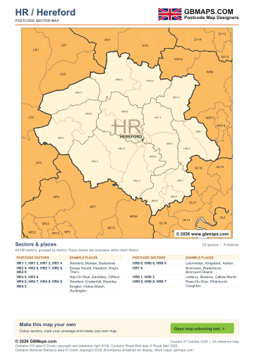
- Full HR postcode-area coverage
- PDF with GBMaps branding
- Includes a map colouring tool link
PDF
FreePDF download
For non-commercial use
Hereford postcode sector maps · Free PDF and complete map bundle
Welcome back
Access your saved maps and downloads.
Need help accessing your account? Contact GBMaps.
HEREFORD POSTCODE SECTOR MAP DOWNLOADS
See the 25 postcode sector boundaries within the Hereford (HR) postcode area. Sectors divide districts into smaller areas for more detailed territory planning. Download the branded PDF free, or choose the complete bundle with a clean PDF, editable SVG and PNG, JPG and GIF images.
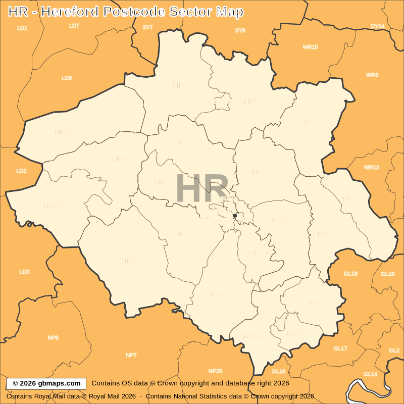
Explore the 25 mapped postcode sectors in the HR postcode area. Download the free Hereford postcode sector map as a PDF, or choose the complete map bundle with a clean PDF, editable SVG and PNG, JPG and GIF images.
FreePDF download
For non-commercial use
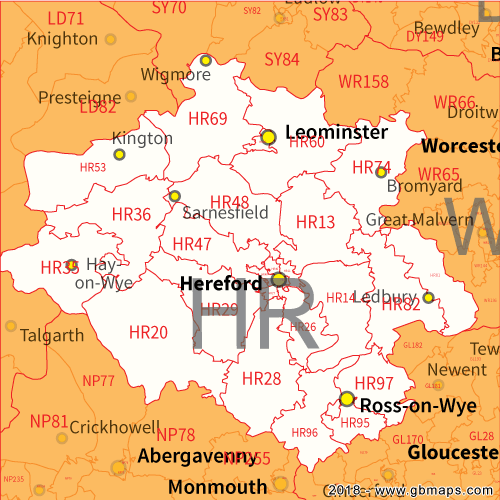
£12including VAT
£10 + £2 VAT · One-off payment
The free PDF needs no email, account or payment. The bundle includes all five formats in one ZIP. Required map-data copyright credits are retained in both versions.

POSTCODE SECTOR COLOURING TOOL
See HR postcode sectors divided into 4 example territories, then use the online colouring tool to build a map for your sales or delivery areas.
Open the sector map colouring toolHR POSTCODE SECTORS AND PLACES
These 22 sectors each introduce at least one named place or locality not already shown in this directory. The complete map contains 25 sectors. Names are matched to sectors and grouped by shared outward code.
| Sector | Local places |
|---|---|
| HR1 postcode sectors | |
| HR1 1 | Hereford, Tupsley |
| HR1 3 | Marden, Bodenham, Bodenham Moor, Bowley, Burley Gate, Felton |
| HR1 4 | Bartestree, Brockhampton, Clouds, Dormington, Fawley Chapel, Fownhope |
| HR2 postcode sectors | |
| HR2 0 | Ewyas Harold, Abbey Dore, Bacton, Clodock, Craswall, Crossway |
| HR2 6 | Aconbury, Ballingham, Bolstone, Carey, Dinedor |
| HR2 8 | King's Thorn, Bagwyllydiart, Broad Oak, Callow, Garway, Garway Hill |
| HR2 9 | Clehonger, Allensmore, Blakemere, Canon Bridge, Cockyard, Didley |
| HR3 postcode sectors | |
| HR3 5 | Hay-On-Wye, Clifford, Cusop, Hardwicke, Pen-Y-Park, Priory Wood |
| HR3 6 | Eardisley, Ailey, Almeley, Bredwardine, Brilley, Brobury |
| HR4 postcode sectors | |
| HR4 0 | King's Acre, Swainshill |
| HR4 7 | Credenhill, Bishopstone, Bridge Sollers, Brinsop, Burghill, Byford |
| HR4 8 | Weobley, Birley, Bush Bank, Canon Pyon, Dilwyn, Haven |
| Sector | Local places |
|---|---|
| HR4 postcode sectors (continued) | |
| HR4 9 | Holmer |
| HR5 postcode sectors | |
| HR5 3 | Kington, Holme Marsh, Huntington, Kingswood, Lower Hergest, Lyonshall |
| HR6 postcode sectors | |
| HR6 0 | Leominster, Ashton, Aulden, Bircher, Brierley, Docklow |
| HR6 9 | Kingsland, Aymestrey, Bearwood, Broxwood, Cholstrey, Cobnash |
| HR7 postcode sectors | |
| HR7 4 | Bromyard, Bredenbury, Bromyard Downs, Collington, Edvin Loach, Edwyn Ralph |
| HR8 postcode sectors | |
| HR8 1 | Ledbury, Bosbury, Callow Marsh, Castle Frome, Coddington, Eastnor |
| HR8 2 | Ashperton, Aylton, Canon Frome, Green Lane, Little Marcle |
| HR9 postcode sectors | |
| HR9 5 | Ross-On-Wye, Coughton, Hope Mansell, Kerne Bridge, Walford |
| HR9 6 | Whitchurch, Baysham, Bridstow, Foy, Glewstone, Goodrich |
| HR9 7 | Aston Crews, Brampton Abbotts, Bromsash, Crow Hill, Gorsley Common |
This is a place finder, not a list of every sector or address. A name appears once even when it spans several sectors. Use a current full postcode to check an address.
The free PDF is for non-commercial use and includes GBMaps branding and a map colouring tool link. The paid bundle includes a commercial-use licence, without promotional watermarks or tool links. Required map-data and GBMaps copyright credits remain. Email us about commercial use Map licence terms · Digital delivery and returns.