Free Peterborough PDF Map
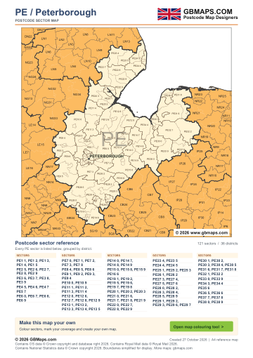
- Full PE postcode-area coverage
- PDF with GBMaps branding
- Includes a map colouring tool link
PDF
FreePDF download
For non-commercial use
Peterborough postcode sector maps · Free PDF and complete map bundle
Welcome back
Access your saved maps and downloads.
Need help accessing your account? Contact GBMaps.
PETERBOROUGH POSTCODE SECTOR MAP DOWNLOADS
See the 121 postcode sector boundaries within the Peterborough (PE) postcode area. Sectors divide districts into smaller areas for more detailed territory planning. Download the branded PDF free, or choose the complete bundle with a clean PDF, editable SVG and PNG, JPG and GIF images.
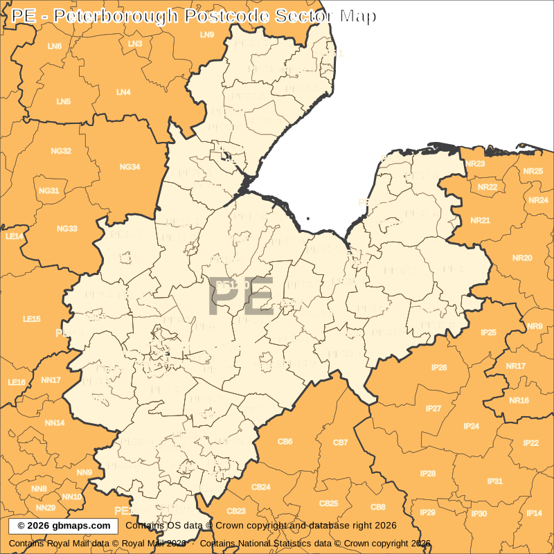
Explore the 121 mapped postcode sectors in the PE postcode area. Download the free Peterborough postcode sector map as a PDF, or choose the complete map bundle with a clean PDF, editable SVG and PNG, JPG and GIF images.
FreePDF download
For non-commercial use

£12including VAT
£10 + £2 VAT · One-off payment
The free PDF needs no email, account or payment. The bundle includes all five formats in one ZIP. Required map-data copyright credits are retained in both versions.

POSTCODE SECTOR COLOURING TOOL
See PE postcode sectors divided into 4 example territories, then use the online colouring tool to build a map for your sales or delivery areas.
Open the sector map colouring toolPE POSTCODE SECTORS AND PLACES
These 93 sectors each introduce at least one named place or locality not already shown in this directory. The complete map contains 121 sectors. Names are matched to sectors and grouped by shared outward code.
| Sector | Local places |
|---|---|
| PE1 postcode sectors | |
| PE1 1 | Peterborough |
| PE1 5 | Newark |
| PE2 postcode sectors | |
| PE2 5 | Orton Longueville |
| PE3 postcode sectors | |
| PE3 6 | Longthorpe |
| PE4 postcode sectors | |
| PE4 6 | Werrington |
| PE5 postcode sectors | |
| PE5 7 | Castor, Ailsworth, Sutton |
| PE6 postcode sectors | |
| PE6 0 | Crowland, North Side, Thorney, Dowsdale |
| PE6 7 | Eye, Etton, Eye Green, Glinton, Helpston, Marholm |
| PE6 8 | Market Deeping, Deeping St James, Frognall |
| PE6 9 | Langtoft, Deeping Gate, Maxey, Northborough, Baston, West Deeping |
| PE7 postcode sectors | |
| PE7 1 | Whittlesey |
| PE7 2 | Coates, Eastrea, Eldernell, Turves |
| PE7 3 | Yaxley, Alwalton, Caldecote, Chesterton, Conington, Denton |
| PE7 8 | Hampton Hargate, Hampton Vale |
| PE8 postcode sectors | |
| PE8 4 | Oundle |
| PE8 5 | Barnwell, Achurch, Apethorpe, Armston, Ashton, Cotterstock |
| PE8 6 | Wittering, Elton, Sibson, Stibbington, Water Newton, Thornhaugh |
| PE9 postcode sectors | |
| PE9 1 | Stamford |
| PE9 3 | Ketton, Bainton, Barnack, Pilsgate, Southorpe |
| PE9 4 | Ryhall, Barholm, Braceborough, Careby, Carlby, Greatford |
| PE10 postcode sectors | |
| PE10 0 | Bourne, Bulby, Cawthorpe, Dowsby, Dunsby, Dyke |
| PE11 postcode sectors | |
| PE11 1 | Spalding |
| PE11 2 | Little London |
| PE11 3 | Crossgate, Deeping St Nicholas, Hop Pole, Northgate, Pinchbeck |
| PE11 4 | Donington, Church End, Donington South Ing, Gosberton, Gosberton Clough, Northorpe |
| PE12 postcode sectors | |
| PE12 0 | Sutton St James, Chapelgate, Gedney, Gedney Broadgate, Gedney Dyke, Gedney Hill |
| PE12 6 | Moulton, Cowbit, Loosegate, Moulton Seas End, Weston, Weston Hills |
| PE12 7 | Holbeach |
| PE12 8 | Fleet Hargate, Fleet, Holbeach Bank, Holbeach Clough, Holbeach Hurn, Holbeach St Johns |
| PE12 9 | Long Sutton, Dawsmere, Gedney Drove End, Guy's Head, Lutton, Sutton Bridge |
| PE13 postcode sectors | |
| PE13 1 | Wisbech |
| PE13 3 | Walsoken |
| PE13 4 | Wisbech St Mary, Gorefield, Guyhirn, Guyhirn Gull, Murrow |
| PE13 5 | Fitton End, Four Gotes, Leverington, Newton, Tydd St Giles |
| PE14 postcode sectors | |
| PE14 0 | Elm, Begdale, Coldham, Friday Bridge |
| PE14 7 | Walpole St Peter, Ingleborough, St John's Fen End, St John's Highway, Terrington St John, Walpole Highway |
| PE14 8 | Outwell, Emneth, Emneth Hungate, Holly End, Marshland St James, Tilney Fen End |
| PE14 9 | Upwell, Christchurch, Lakes End, Three Holes, Tipps End, Welney |
| PE15 postcode sectors | |
| PE15 0 | Wimblington, Benwick, Doddington, Manea, Purls Bridge, Welches Dam |
| PE15 8 | March |
| PE15 9 | Town End |
| PE16 postcode sectors | |
| PE16 6 | Chatteris, Horseway |
| PE19 postcode sectors | |
| PE19 1 | St Neots |
| PE19 2 | Eynesbury |
| PE19 5 | Buckden, Duloe, Staploe, Diddington, Great Staughton, Hail Weston |
| PE19 6 | Little Paxton, Little Barford, Abbotsley, Croxton, Eltisley, Graveley |
| PE19 7 | Eaton Socon |
| PE20 postcode sectors | |
| PE20 1 | Kirton, Frampton, Frampton West End, Kirton End, Kirton Holme, Sandholme |
| PE20 2 | Algarkirk, Fosdyke, Fosdyke Bridge, Sutterton, Sutterton Dowdyke, Wigtoft |
| Sector | Local places |
|---|---|
| PE20 postcode sectors (continued) | |
| PE20 3 | Swineshead, Amber Hill, Bicker, Blackjack, Brothertoft, Fenhouses |
| PE21 postcode sectors | |
| PE21 0 | Boston, Fishtoft |
| PE21 7 | Wyberton |
| PE22 postcode sectors | |
| PE22 0 | Sibsey, Benington, Butterwick, Freiston, Freiston Shore, Haltoft End |
| PE22 7 | Mareham Le Fen, Anton's Gowt, Carrington, Cowbridge, Fishtoft Drove, Frith Bank |
| PE22 8 | Friskney, Eastville, Fold Hill, Friskney Eaudyke, Friskney Tofts, Midville |
| PE22 9 | Wrangle, Lade Bank, Leake Commonside, Leake Hurn's End, Old Leake, Wrangle Bank |
| PE23 postcode sectors | |
| PE23 4 | Old Bolingbroke, Asgarby, Aswardby, Bag Enderby, Dalby, East Keal |
| PE23 5 | Spilsby, Ashby By Partney, Candlesby, Firsby, Great Steeping, Halton Holegate |
| PE24 postcode sectors | |
| PE24 4 | Wainfleet All Saints, Addlethorpe, Croft, Gibraltar, Thorp St Peter, Thorpe Culvert |
| PE24 5 | Chapel St Leonards, Anderby Creek, Authorpe Row, Bratoft, Burgh Le Marsh, Hogsthorpe |
| PE25 postcode sectors | |
| PE25 1 | Skegness, Ingoldmells, Seathorne, Winthorpe |
| PE25 3 | Seacroft |
| PE26 postcode sectors | |
| PE26 1 | Ramsey |
| PE26 2 | Bury, Pondersbridge, Ramsey Forty Foot, Ramsey Heights, Ramsey Mereside |
| PE27 postcode sectors | |
| PE27 3 | St Ives |
| PE27 4 | Needingworth, Holywell |
| PE28 postcode sectors | |
| PE28 0 | Kimbolton, Hargrave, Lower Dean, Shelton, Upper Dean, Bythorn |
| PE28 2 | Warboys, Abbots Ripton, Fenton, Great Raveley, Houghton, Kings Ripton |
| PE28 3 | Somersham, Bluntisham, Broughton, Colne, Earith, Oldhurst |
| PE28 4 | Brampton, Alconbury, Alconbury Weston, Great Stukeley, Little Stukeley |
| PE28 5 | Sawtry, Barham, Brington, Buckworth, Coppingford, Glatton |
| PE28 9 | Hemingford Grey, Fenstanton, Hemingford Abbots, Hilton |
| PE29 postcode sectors | |
| PE29 1 | Huntingdon, Hartford |
| PE29 2 | Godmanchester |
| PE30 postcode sectors | |
| PE30 1 | King's Lynn |
| PE30 3 | North Wootton, South Wootton |
| PE30 4 | Gaywood |
| PE31 postcode sectors | |
| PE31 6 | Dersingham, Anmer, Bagthorpe, Bircham Newton, Bircham Tofts, Castle Rising |
| PE31 7 | Heacham, Snettisham |
| PE31 8 | Burnham Market, Barmer, Brancaster, Brancaster Staithe, Burnham Deepdale, Burnham Norton |
| PE32 postcode sectors | |
| PE32 1 | Gayton, Ashwicken, Bawsey, Blackborough End, Congham, East Walton |
| PE32 2 | Castle Acre, Beeston, East Lexham, Great Dunham, Great Massingham, Great Palgrave |
| PE33 postcode sectors | |
| PE33 0 | West Winch, North Runcton, Runcton Holme, Setchey, Shouldham, Shouldham Thorpe |
| PE33 9 | Marham Airfield, Barton Bendish, Boughton, Crimplesham, Fincham, Gooderstone |
| PE34 postcode sectors | |
| PE34 3 | West Lynn, Saddle Bow, Stow Bardolph, Stow Bridge, Tilney Cum Islington, Wiggenhall St Germans |
| PE34 4 | Terrington St Clement, Clenchwarton, Hay Green, Ongar Hill, Tilney All Saints, Tilney High End |
| PE35 postcode sectors | |
| PE35 6 | Sandringham |
| PE36 postcode sectors | |
| PE36 5 | Hunstanton, Ringstead, Sedgeford |
| PE36 6 | Holme Next The Sea, Old Hunstanton, Thornham |
| PE37 postcode sectors | |
| PE37 7 | Swaffham |
| PE37 8 | Necton, Beachamwell, Cockley Cley, Ivy Todd, North Pickenham, South Pickenham |
| PE38 postcode sectors | |
| PE38 0 | Hilgay, Barroway Drove, Brandon Bank, Brandon Creek, Denver, Fordham |
| PE38 9 | Downham Market, Bexwell |
This is a place finder, not a list of every sector or address. A name appears once even when it spans several sectors. Use a current full postcode to check an address.
The free PDF is for non-commercial use and includes GBMaps branding and a map colouring tool link. The paid bundle includes a commercial-use licence, without promotional watermarks or tool links. Required map-data and GBMaps copyright credits remain. Email us about commercial use Map licence terms · Digital delivery and returns.