FREE NORWICH POSTCODE SECTOR MAP
NR – Norwich Postcode Sector Map 100 mapped sectors · NR1 1 to NR35 2
Explore the 100 mapped postcode sectors in the NR postcode area. The map labels sectors; the directory highlights those with distinct sector-matched places and localities.
Download the Norwich postcode sector map
Orange sector artwork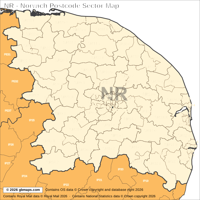
Free editable vector postcode map downloads
Also available as free postcode map images

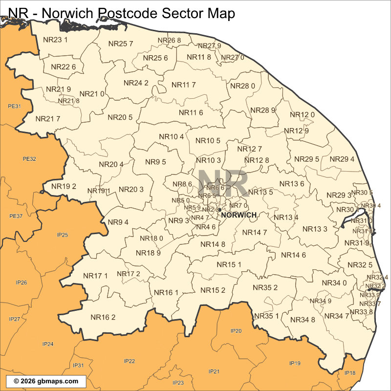
PDF and SVG remain sharp at any size. PNG, JPG and GIF are 800-pixel images. Check the map credits before reuse.

POSTCODE SECTOR COLOURING TOOL
Make your own Norwich sector map
See NR postcode sectors divided into 4 example territories, then use the online colouring tool to build a map for your sales or delivery areas.
Open the sector map colouring toolNR POSTCODE SECTORS AND PLACES
NR postcode sector directory
These 80 sectors each introduce at least one named place or locality not already shown in this directory. The complete map contains 100 sectors. Names are matched to sectors and grouped by shared outward code.
| Sector | Local places |
|---|---|
| NR1 postcode sectors | |
| NR1 1 | Norwich |
| NR1 2 | Lakenham |
| NR2 postcode sectors | |
| NR2 2 | Eaton |
| NR2 3 | Earlham |
| NR4 postcode sectors | |
| NR4 6 | Keswick |
| NR4 7 | Colney, Cringleford |
| NR5 postcode sectors | |
| NR5 0 | New Costessey |
| NR5 9 | Bowthorpe |
| NR6 postcode sectors | |
| NR6 5 | Hellesdon |
| NR6 7 | Old Catton |
| NR7 postcode sectors | |
| NR7 0 | Thorpe End, Thorpe St Andrew |
| NR7 8 | Sprowston |
| NR8 postcode sectors | |
| NR8 5 | Costessey |
| NR8 6 | Taverham, Drayton, Ringland, Thorpe Marriot |
| NR9 postcode sectors | |
| NR9 3 | Hethersett, Bawburgh, High Green, Little Melton |
| NR9 4 | Hingham, Barford, Barnham Broom, Brandon Parva, Carleton Forehoe, Coston |
| NR9 5 | Easton, Alderford, Attlebridge, Colton, Honingham, Lenwade |
| NR10 postcode sectors | |
| NR10 3 | Horsford, Hainford, Horsham St Faith, Newton St Faith, Spixworth, Waterloo |
| NR10 4 | Reepham, Booton, Brandiston, Cawston, Eastgate, Felthorpe |
| NR10 5 | Buxton, Brampton, Hevingham, Lamas, Little Hautbois, Marsham |
| NR11 postcode sectors | |
| NR11 6 | Aylsham, Blickling, Burgh Next Aylsham, Corpusty, Heydon, Ingworth |
| NR11 7 | Aldborough, Alby Hill, Banningham, Bessingham, Calthorpe, Colby |
| NR11 8 | Mundesley, Aylmerton, East Beckham, Felbrigg, Gimingham, Gresham |
| NR12 postcode sectors | |
| NR12 0 | Bacton, Bacton Green, Eccles On Sea, Happisburgh, Happisburgh Common, Hempstead |
| NR12 7 | Coltishall, Crostwick, Frettenham, Great Hautbois, Horstead |
| NR12 8 | Hoveton, Ashmanhaugh, Barton Turf, Belaugh, Horning, Irstead |
| NR12 9 | Stalham, East Ruston, Ingham, Smallburgh, Stalham Green, Sutton |
| NR13 postcode sectors | |
| NR13 3 | Acle, Beighton, Cantley, Damgate, Freethorpe, Halvergate |
| NR13 4 | Lingwood, Blofield, Blofield Heath, Buckenham, Hassingham, Hemblington |
| NR13 5 | Brundall, Great Plumstead, Little Plumstead, Postwick |
| NR13 6 | Salhouse, Cargate Green, New Rackheath, Panxworth, Rackheath, Ranworth |
| NR14 postcode sectors | |
| NR14 6 | Loddon, Chedgrave, Haddiscoe, Hales, Hardley Street, Langley Street |
| NR14 7 | Upper Stoke, Ashby St Mary, Bramerton, Claxton, Framingham Earl, Framingham Pigot |
| NR14 8 | Mulbarton, Arminghall, Bracon Ash, Caistor St Edmund, Dunston, East Carleton |
| NR15 postcode sectors | |
| NR15 1 | Newton Flotman, Bergh Apton, Brooke, Flordon, Hapton, Howe |
| NR15 2 | Long Stratton, Aslacton, Fritton, Great Moulton, Hardwick, Hempnall |
| NR16 postcode sectors | |
| NR16 1 | Forncett End, Ashwellthorpe, Bunwell, Bunwell Hill, Carleton Rode, Forncett St Mary |
| NR16 2 | East Harling, Banham, Bridgham, Eccles Road, Kenninghall, Larling |
| NR17 postcode sectors | |
| NR17 1 | Attleborough, Caston, Great Ellingham, Little Ellingham, Lower Stow Bedon, Northacre |
| NR17 2 | Besthorpe |
| NR18 postcode sectors | |
| NR18 0 | Wymondham, Wramplingham |
| Sector | Local places |
|---|---|
| NR18 postcode sectors (continued) | |
| NR18 9 | Crownthorpe, Deopham, Deopham Green, Hackford, Ketteringham |
| NR19 postcode sectors | |
| NR19 1 | Dereham, Clint Green, Toftwood, Westfield, Whinburgh, Yaxham |
| NR19 2 | Bittering, Great Fransham, Little Fransham, Longham, Podmore |
| NR20 postcode sectors | |
| NR20 3 | Mattishall, East Tuddenham, Elsing, Hockering, Mattishall Burgh, Mill Street |
| NR20 4 | Swanton Morley, Bawdeswell, Beetley, Billingford, East Bilney, Foxley |
| NR20 5 | North Elmham, Bintree, Brisley, Foulsham, Gateley, Guestwick |
| NR21 postcode sectors | |
| NR21 0 | Little Snoring, Bale, Barney, Binham, East Barsham, Fulmodeston |
| NR21 7 | Wicken Green, Colkirk, Dunton, East Raynham, Helhoughton, Hempton |
| NR21 8 | Fakenham |
| NR21 9 | North Creake, Sculthorpe, South Creake, West Barsham |
| NR22 postcode sectors | |
| NR22 6 | Little Walsingham, Great Walsingham, Houghton St Giles, North Barsham, Waterden |
| NR23 postcode sectors | |
| NR23 1 | Wells-Next-The-Sea, Cockthorpe, Holkham, Stiffkey, Warham, Wighton |
| NR24 postcode sectors | |
| NR24 2 | Briston, Briningham, Brinton, Edgefield, Edgefield Street, Gunthorpe |
| NR25 postcode sectors | |
| NR25 6 | Holt, Baconsthorpe, Bodham, High Kelling, West Beckham |
| NR25 7 | Blakeney, Cley Next The Sea, Field Dalling, Glandford, Kelling, Langham |
| NR26 postcode sectors | |
| NR26 8 | Sheringham, Beeston Regis, Upper Sheringham |
| NR27 postcode sectors | |
| NR27 0 | Cromer, Northrepps, Overstrand, Sidestrand |
| NR27 9 | Crossdale Street, East Runton, West Runton |
| NR28 postcode sectors | |
| NR28 0 | North Walsham, Antingham, Bradfield, Felmingham, Knapton, Swafield |
| NR28 9 | Crostwight, Dilham, Edingthorpe, Honing, Paston |
| NR29 postcode sectors | |
| NR29 3 | Ormesby, Billockby, California, Clippesby, Filby, Fleggburgh (Burgh St Margaret) |
| NR29 4 | Martham, East Somerton, Hemsby, Horsey, Newport, West Somerton |
| NR29 5 | Rollesby, Bastwick, Catfield, How Hill, Ludham, Potter Heigham |
| NR30 postcode sectors | |
| NR30 1 | Great Yarmouth |
| NR30 3 | South Denes |
| NR30 5 | Caister-On-Sea, West Caister, West End |
| NR31 postcode sectors | |
| NR31 6 | Gorleston-On-Sea |
| NR31 8 | Bradwell |
| NR31 9 | Belton, Burgh Castle, Hopton On Sea, St Olaves |
| NR32 postcode sectors | |
| NR32 1 | Lowestoft |
| NR32 5 | Corton, Blundeston, Camps Heath, Herringfleet, Lound, Oulton |
| NR33 postcode sectors | |
| NR33 7 | Kessingland, Kirkley, Pakefield |
| NR33 8 | Carlton Colville, Gisleham, Rushmere |
| NR33 9 | Oulton Broad |
| NR34 postcode sectors | |
| NR34 0 | Geldeston, Aldeby, Burgh St Peter, Gillingham, Maypole Green, Stockton |
| NR34 7 | Beccles, Barnby, Benacre, Covehithe, Cuckold's Green, Ellough |
| NR34 8 | Wangford, Barnaby Green, Barsham, Brampton Street, Clay Common |
| NR35 postcode sectors | |
| NR35 1 | Bungay, Flixton, High Street, Ilketshall St Margaret, Mettingham, St Michael South Elmham |
| NR35 2 | Ditchingham, Broome, Earsham, Ellingham, Hedenham, Kirby Cane |
This is a place finder, not a list of every sector or address. A name appears once even when it spans several sectors. Use a current full postcode to check an address.
Looking for another postcode area?
Our maps are free for non-commercial use. Commercial use requires a licence for a small one-off charge. Please retain all supplied copyright notices. The GBMaps copyright notice must appear on the map itself in every format; vector maps (PDF and SVG) must also display the Ordnance Survey, Royal Mail and other supplied data acknowledgements. Email us about commercial use.