Customise your own maps, online, in minutes download them as PDF maps & Excel spreadsheet files.
You MUST try our online Map Colouring Tools before looking at any of our other products. Don’t get me wrong, we do have some great mapping products on our site but I personally designed and built our mapping tools to cater specifically for the needs of the majority of visitors to our site. It really is a cracking little tool and dead simple to use. Click the green buttons below to try!
If you have any problems just give me a call, I'm the developer; Andrew Scott - 01751 473136.
You can try our fully functional mapping tools without giving up your privacy.
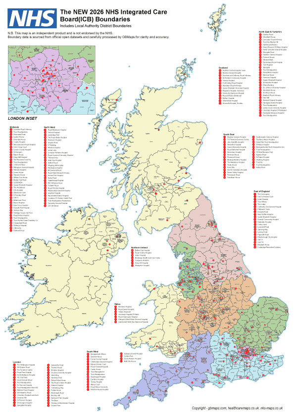
We've compiled a full NHS UK Vector Map consisting of the English CCG's, Scottish Health Boards, Northern Ireland Social Care Trusts and the Welsh University Health Boards This is a unique map with all areas seperated onto different layers and grouped into the correct regions. Scotland is all one region England is made up of the 7 main CCG regions while Wales and Northern Ireland are grouped into their respective regions. If editing this map in adobe illustrator it is possible to show or hide any of the regions, countries or areas easily and it's also very easy to identify individual trusts in order to group them into your own territories.
Charging the correct fee for delivering goods locally is more important than ever. It can lose you considerable amounts of money if your charging zones are not accurate. We can create bespoke maps specifically tailored to your business showing exactly where each of your delivery charging zones begins and ends. When your customers can see clearly and quickly how much a delivery is going to cost it gives them confidence in your service and enables a speedy purchase process. We can calculate the most efficient charging zones specifically for your business so you don’t lose out on delivery fess ever again. Take a look at some sample drive-time maps, isochrone maps and delivery zone maps. We will create a free sample specifically for you if you get in touch with your requirements.
Download postcode maps of the UK as editable Illustrator files. We have many different versions of UK Maps including areas, district and sector maps of Great Britain including northern and southern Ireland. Different levels of postcode map detail available for immediate purchase and download as fully layered original illustrator vector artwork files. Many of the maps include town and city names along with all postcode borders stored as vector shapes which can all be individually coloured. These files are ideal for graphic designers and people with experience of graphics editing software.
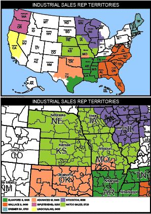
If you want customise your own UK postcode map then our dedicated online map colouring tools will be right up your street. Segment a map into coloured zones or territories, add different styles of labels, create delivery zones, show a detailed legend, group and colour the postcode areas or districts into up to 52 different coloured territories. Create a choropleth map or postcode based heatmap of your data without any knowledge of graphics software or mapping software. Sales area territory mapping and delivery zone planning are all a breeze with this web based mapping software.
HolidayParkMaps.com is where we design our Caravan Park Map, Holiday Park Maps and Campsite maps. Designed in a 3D style specifically for your park and in a colour scheme of your choice they are the best you can buy. Download PDF camp site, leisure park and holiday park maps & plans from the website. We have over 400 maps for caravan parks across the world including Europe, Australia, UK & USA. People will see your Park Map before they see your reception, make sure you're giving your customers the very est first impression with a professionally designed caravan park map by HolidayParkMaps.com
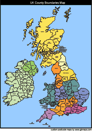
Our UK County Boundaries maps are delivered as Vactor Illustrator Files, JPG and Editable Power-point files. All the county boundaries are separate editable shapes and the illustrator map files are completely layered which means areas and features of the map can be shown or hidden from view easily. With little experience you can edit the files and create you r own maps for use in presentations, projects, planning applications and moore
All 120 Postcode Areas in the UK are split up further into postcode districts. We've taken the huge step to release the entire postcode districts map dataset to the public completely free of charge for single use. Download vector PDF postcode district maps of of every postcode Area in the UK here, editable with Adobe Illustrator and free to download. You could also try out Territory Mapping Tool here for a more fully featured solution.
We develop web based mapping software for any purpose and at any scale. We can develop highly complex applications capable of doing amazing things with your data yet remain very simple to use. GBMaps can produce individual maps
to display your data from drive time-maps, isochrone maps, heat maps and cluster point mapping. If you need to display data on a map but don't know exactly what it is you want then give us a call .
Our UK County Boundaries maps are delivered as Illustrator, JPG and Power-point files. All the county boundaries are separate editable shapes and the illustrator map files are layered which mean that areas and features of the map can be shown or hidden from view easily.
This London postcode area, district and sector map is fully editable using a vector editing software package such as adobe illustrator or you can buy an unlock code to use our online tool to customise the map into up to 52 different coloured zones then save the result as a hi-res PDF map.
European postcodes are difficult because every country has a slightly different system. We have brought together all these countries in order to build one of the most comprehensive postcode/zip-code maps of Europe there is available as a vector editable map for download.