FREE KINGSTON UPON THAMES POSTCODE DISTRICT MAP DOWNLOAD
KT – Kingston upon Thames Postcode District Map 24 districts KT1 to KT24 · Free editable vector PDF/SVG and PNG/JPG/GIF images
Explore the 24 KT postcode districts in the Kingston upon Thames postcode area, from KT1 to KT24. Download the map free as an editable vector PDF or SVG, or choose a PNG, JPG or GIF image. Find each district’s post town and local places in the directory below.
Download the Kingston upon Thames postcode district map for free
2026 map artwork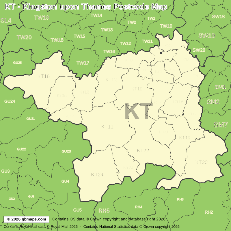
Free editable vector postcode map downloads
Also available as free postcode map images
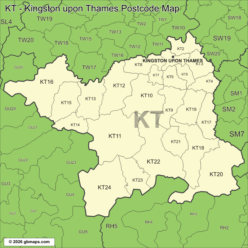
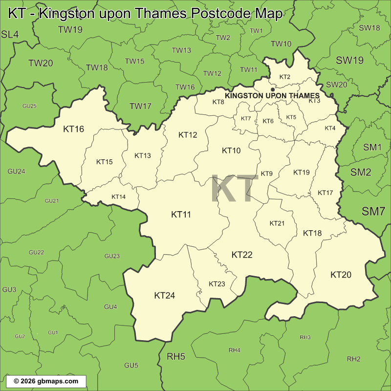
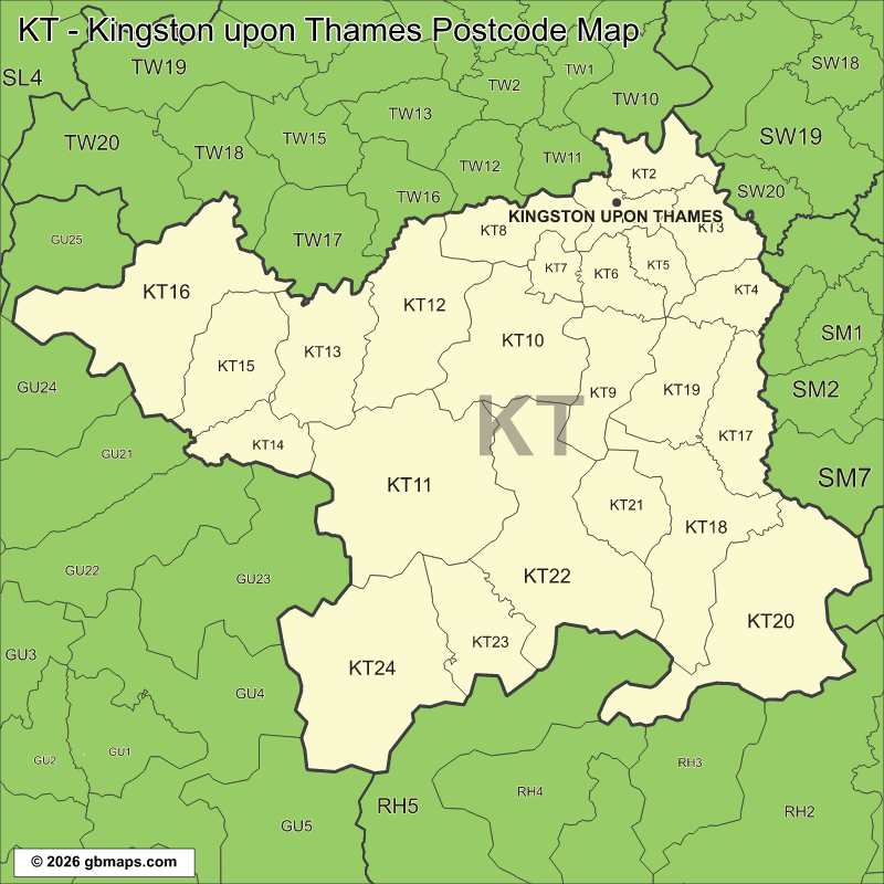
PDF and SVG remain sharp at any size. PNG, JPG and GIF are 800-pixel images. Check the map credits before reuse.

KINGSTON UPON THAMES MAP COLOURING TOOL
Colour your own Kingston upon Thames postcode district map
Use our online tool to colour postcode districts, add your own labels and make a Kingston upon Thames map for your project.
Make a map of Kingston upon Thames postcode districts hereKT – KINGSTON UPON THAMES POSTCODE DISTRICTS AND LOCAL PLACES
KT postal code district directory
Find a district code and a few local places associated with it. Post towns group the entries so each postal name is easy to scan.
| District | Local places |
|---|---|
| Kingston Upon Thames | |
| KT1 | Kingston upon Thames, Hampton Wick, Norbiton |
| KT2 | Kingston Hill |
| New Malden | |
| KT3 | New Malden, Coombe, Old Malden |
| Worcester Park | |
| KT4 | Worcester Park |
| Surbiton | |
| KT5 | Tolworth, Berrylands |
| KT6 | Surbiton, Long Ditton, Southborough |
| Thames Ditton | |
| KT7 | Thames Ditton, Weston Green |
| East Molesey; West Molesey | |
| KT8 | East Molesey, Hampton Court, West Molesey |
| Chessington | |
| KT9 | Hook, Chessington, Malden Rushett |
| Esher | |
| KT10 | Esher, Claygate, Hinchley Wood |
| Cobham | |
| KT11 | Cobham, Stoke D'Abernon, Martyr's Green |
| Walton-On-Thames | |
| KT12 | Walton-on-Thames, Hersham, Burwood Park |
| District | Local places |
|---|---|
| Weybridge | |
| KT13 | Weybridge, St George's Hill, Brooklands |
| West Byfleet | |
| KT14 | West Byfleet, Byfleet |
| Addlestone | |
| KT15 | Addlestone, Woodham, New Haw |
| Chertsey | |
| KT16 | Chertsey, Lyne, Ottershaw |
| Epsom | |
| KT17 | Ewell, Nork, Stoneleigh |
| KT18 | Headley, Great Burgh, Woodcote |
| KT19 | Epsom, West Ewell, Manor Park |
| Tadworth | |
| KT20 | Kingswood, Lower Kingswood, Tadworth |
| Ashtead | |
| KT21 | Ashtead, Lower Ashtead, Ashtead Common |
| Leatherhead | |
| KT22 | Leatherhead, Fetcham, Oxshott |
| KT23 | Little Bookham, Great Bookham, Isle of Wight |
| KT24 | East Horsley, West Horsley, Effingham |
District codes are not always consecutive. Place names are examples, not a complete address lookup. Use the full postcode for an exact address.
Looking for another postcode area?
Our maps are free for non-commercial use. Commercial use requires a licence for a small one-off charge. Please retain all supplied copyright notices. The GBMaps copyright notice must appear on the map itself in every format; vector maps (PDF and SVG) must also display the Ordnance Survey, Royal Mail and other supplied data acknowledgements. Email us about commercial use.