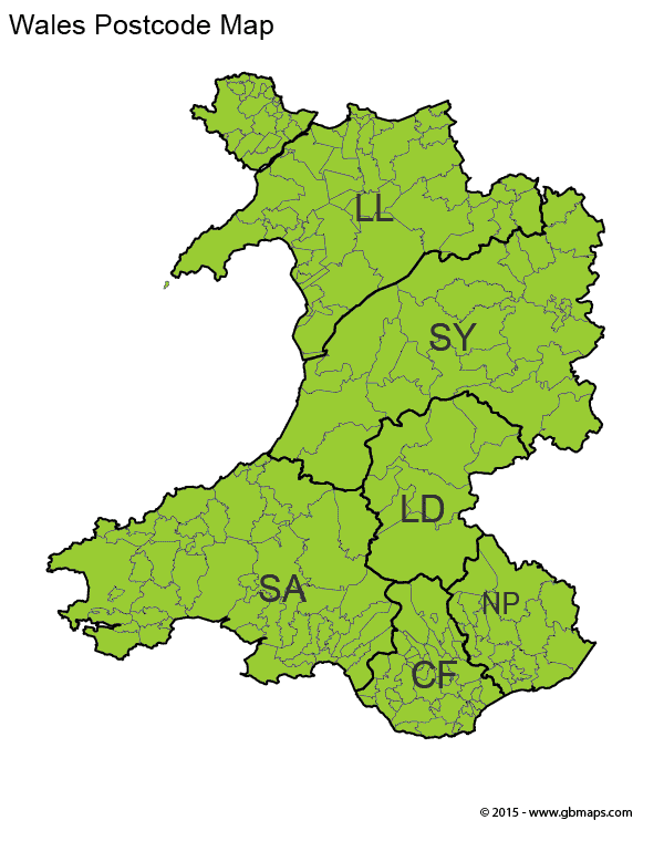
Detailed Welsh Postcode District Maps of All Postcode Areas in Wales
Discover the complete range of Welsh postcode district maps, perfect for anyone needing comprehensive details of all postcode areas in Wales. Our downloadable, vector-based PDF maps cover every postcode area in Wales, thoroughly divided into their respective districts. Ideal for residents, businesses, and logistical planning, these maps are meticulously labeled to ensure you can easily identify each area and district within Wales. To access your desired Welsh postcode district map, simply click on the links provided on the right-hand side of this page.

 CF Cardiff
 LD Landrindod
 LL Wrexham
 NP Newport
 SA Swansea
 SY Shrewsbury