FREE UK VILLAGE STREET MAPS · SIR YNYS MON - ISLE OF ANGLESEY
Free Valley / Y Fali street map
Valley / Y Fali is in Sir Ynys Mon - Isle of Anglesey, within the LL65 postcode district. Explore its streets on the free map below. Our collection includes 8 village maps for Sir Ynys Mon - Isle of Anglesey and 87 in the LL postcode area.
2 village maps in LL65. Postcodes & local information
No email or account needed. Keep the map credits when sharing or printing.
Your free Valley / Y Fali map
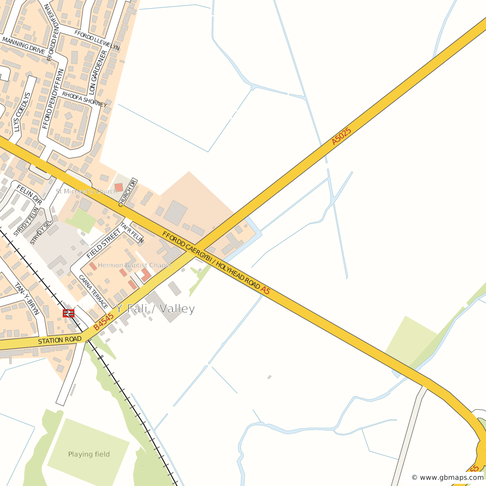
The smaller free Valley / Y Fali village map. Click the map to see the wider area.
Please retain the map’s copyright credits. Map usage information
Valley / Y Fali map details
- Smaller map
- 1km × 1km · SVG on this page; free PDF download
- Larger download
- 3km × 3km · PNG, PDF, SVG and AI in one ZIP
- Image size
- Purchased PNG: 3,000 × 3,000 pixels. Web preview: 1,200 × 1,200.
- Edition & use
- November 2026 · Sources and map guidance · Usage terms
The smaller Valley / Y Fali map includes Felin Dir, Tan-Y-Bryn, Stryd Y Sel, Tai'R Felin. Compare the two views above to check the area you need.
The £15 bundle includes VAT and has no preview watermark. The smaller PDF downloads free without an email address or account. Optional email updates are offered separately.
Valley / Y Fali street names
Within the smaller map’s coverage
- Carna Terrace
- Church Drive
- Felin Dir
- Fford Pendyffryn
- Ffordd Caergybi / Holyhead Road
- Ffordd Llewelyn
- Ffordd Pendyferyn
- Field Street
- Llys Coedlys
- Lon Gardener
- Manning Drive
- Rhodfa Shorney
- Station Road
- Stryd Y Felin
- Stryd Y Sel
- Tai'r Felin
- Tan-Y-Bryn
More Village Maps near Valley / Y Fali

LL · Llandudno POSTCODE MAPS
Colour a postcode map around Valley / Y Fali
Build a postcode map for the wider Llandudno (LL) area shown here. Use it to plan delivery zones, sales territories or service coverage around Valley / Y Fali.
Use districts for a regional overview or sectors for smaller local areas. Add your own colours and labels, or ask the map assistant to group areas into territories.
Opens the UK postcode map. Find the LL area in the tool to work around Valley / Y Fali.
THE LOCAL PICTURE
About Valley / Y Fali & the surrounding area
Postcodes & local area
- Sector
- LL65 3
- District
- LL65
- Area
- LL
- Place
- Valley / Y Fali
- County / area
- Sir Ynys Mon - Isle of Anglesey
- Ward (2015 record)
- Llifôn
- Parish
- Valley Community
- District (original record)
- Isle of Anglesey
- Country
- Wales
Health & care
From the existing village records
- GP surgery2.2 mi
- Valley Medical CentreValley Medical Centre, Johnson Street, Stocksbridge Sheffield, South Yorkshire, S36 1BX
- NHS trust
- Betsi Cadwaladr University Health BoardYsbyty Gwynedd, LL57 2PW
- Integrated care system (original record)
- Betsi Cadwaladr University Health BoardArea listed for this system: Isle of Anglesey · Wales
Travel & local services
Locations listed in the original records
| Place / service | Distance |
|---|---|
| Rail stationValley | 0.2 mi |
| Police stationBethesda Police Station | 21.7 mi |
| Swimming poolPlas Arthur | 10.1 mi |
| CinemaMarine Point | 63.5 mi |
| Fire stationTywyn Fire Station | 52 mi |
| CampsitePen y Bont Caravan and Camping Site | 0.8 mi |
About these Valley / Y Fali maps
What is the difference between the free and paid maps?
The smaller view shows approximately 1.00km × 1.00km around Valley / Y Fali. The free PDF artwork covers 1km × 1km. The £15 bundle covers 3km × 3km and includes PNG, PDF, SVG and Adobe Illustrator (AI) files. Select either option to compare the map views.
What is included in the download bundle?
The larger-area map as a PNG image, a PDF, an editable SVG and an Adobe Illustrator (AI) file, all for £15 including VAT. Purchased files have no preview watermark.
How do I get the smaller PDF?
Choose Download Smaller Free Map. The PDF downloads immediately, with no email address, account or payment needed. Optional GBMaps email updates are offered separately.
Can I save the free SVG map?
Yes. The smaller map displayed here is an SVG image. You can save it using your browser, or save the free Valley / Y Fali SVG map. Keep the copyright credits and follow our map usage terms. This SVG does not require an email address.
How current is the map?
This is the November 2026 artwork edition. That is the production edition, not a survey date: the underlying street-data release dates have not been verified. Check the displayed streets and coverage before choosing a download. Read about the map sources and limitations.
What size is the purchased PNG?
The larger Valley / Y Fali PNG is 3,000 × 3,000 pixels, covering 3km × 3km. The watermarked website preview is 1,200 × 1,200 pixels. The purchased bundle is one ZIP containing PNG, PDF, SVG and Adobe Illustrator files, with no preview watermark.
Where are my purchased downloads?
Use Find your downloads to request access using your purchase email address. Your private download link opens the download box on this map page. Keep that link private.
Where can I find more maps?
Use the nearby town and village links above, or browse our city maps, town maps and village maps. For a customised regional map, try the postcode colouring tool.
Place-name reference data: Contains OS data © Crown Copyright and database rights 2026. Contains Royal Mail data © Royal Mail copyright and database right 2026. Contains National Statistics data © Crown copyright and database right 2026.