Create a postcode map from Excel
Show your sales territories, delivery zones or service areas on a coloured UK map.
Start with your postcode list and territory names. Open your coloured map in our map tool, ready to make it your own.
Your map opens automatically when your spreadsheet is ready.
See how to set up your spreadsheet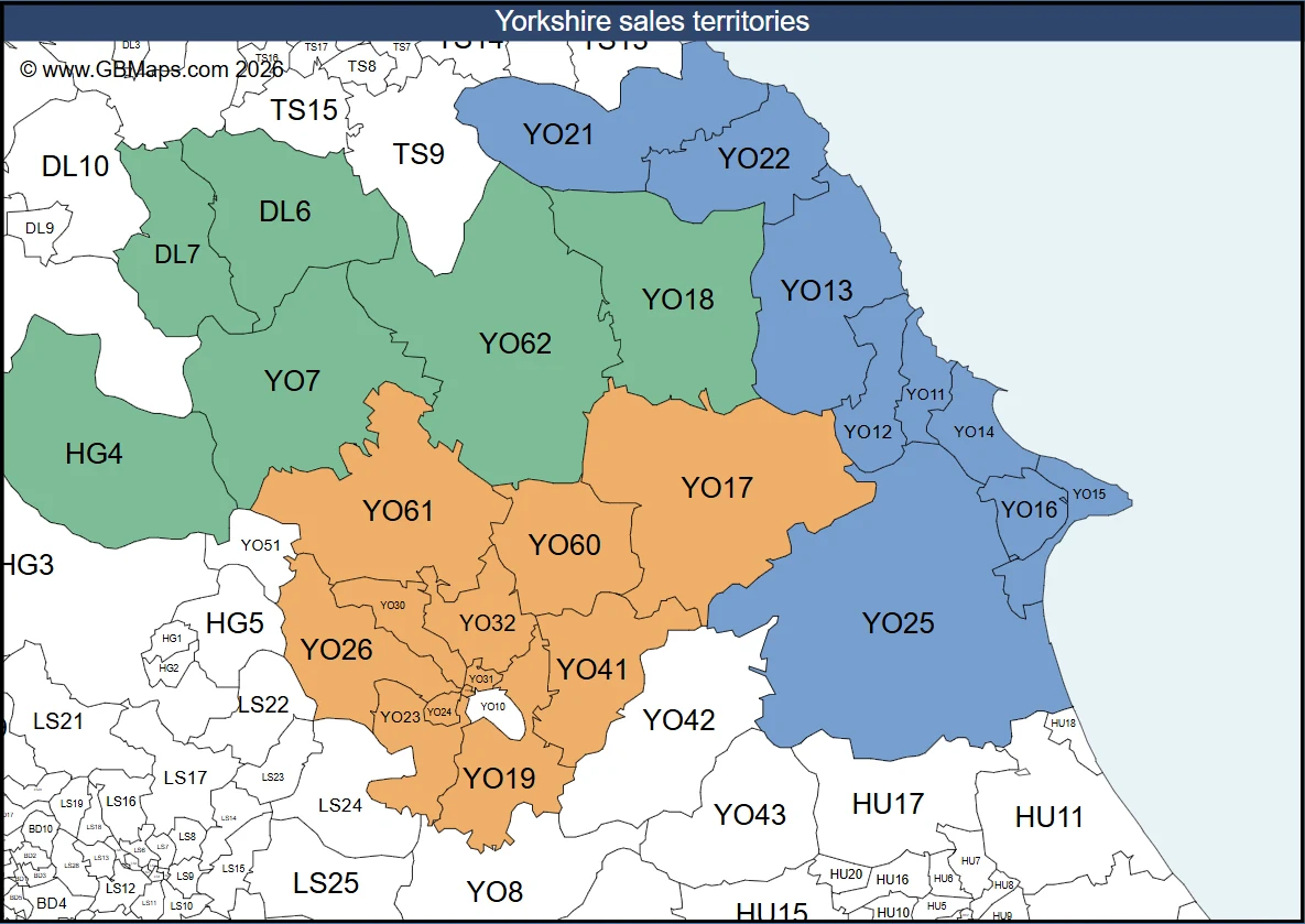
Each territory has its own colour.
- Sales territories
- Delivery zones
- Service areas
- Customer coverage
Create your map in three steps
No need to colour each postcode by hand. Start with the data you already have, then add the finishing touches in the editor.
Add your spreadsheet
Use a list of UK postcodes with a team, territory or delivery zone for each row.
We colour your postcodes
Your groups become coloured areas. If we need more information, we ask a short question.
Continue in the map editor
Continue in the GBMaps tool. Change colours, add labels and get your map ready to share.
How to prepare your spreadsheet
Put your postcodes in one column and your territory names in another. Rows with the same territory name get the same colour.
Use names that mean something to you: sales teams, delivery zones or service areas. You can change the colours and names in the map tool.
- File formats
- Excel (.xlsx), CSV or TSV
- File size
- Up to 6 MB and 5,000 rows
- Territories
- Up to 20 groups per map
- Older Excel files
- Save .xls files as .xlsx or CSV first
| Postcode | Territory |
|---|---|
| YO7 | North team |
| YO18 | North team |
| YO17 | York team |
| YO19 | York team |
| YO13 | Coastal team |
| YO25 | Coastal team |
Edit your map to suit your business
Your spreadsheet gets you started. The full GBMaps editor gives you control over the result.
- Change territory colours and names
- Add your title, notes and company logo
- Adjust the map view and page layout
- Save and download with a map licence
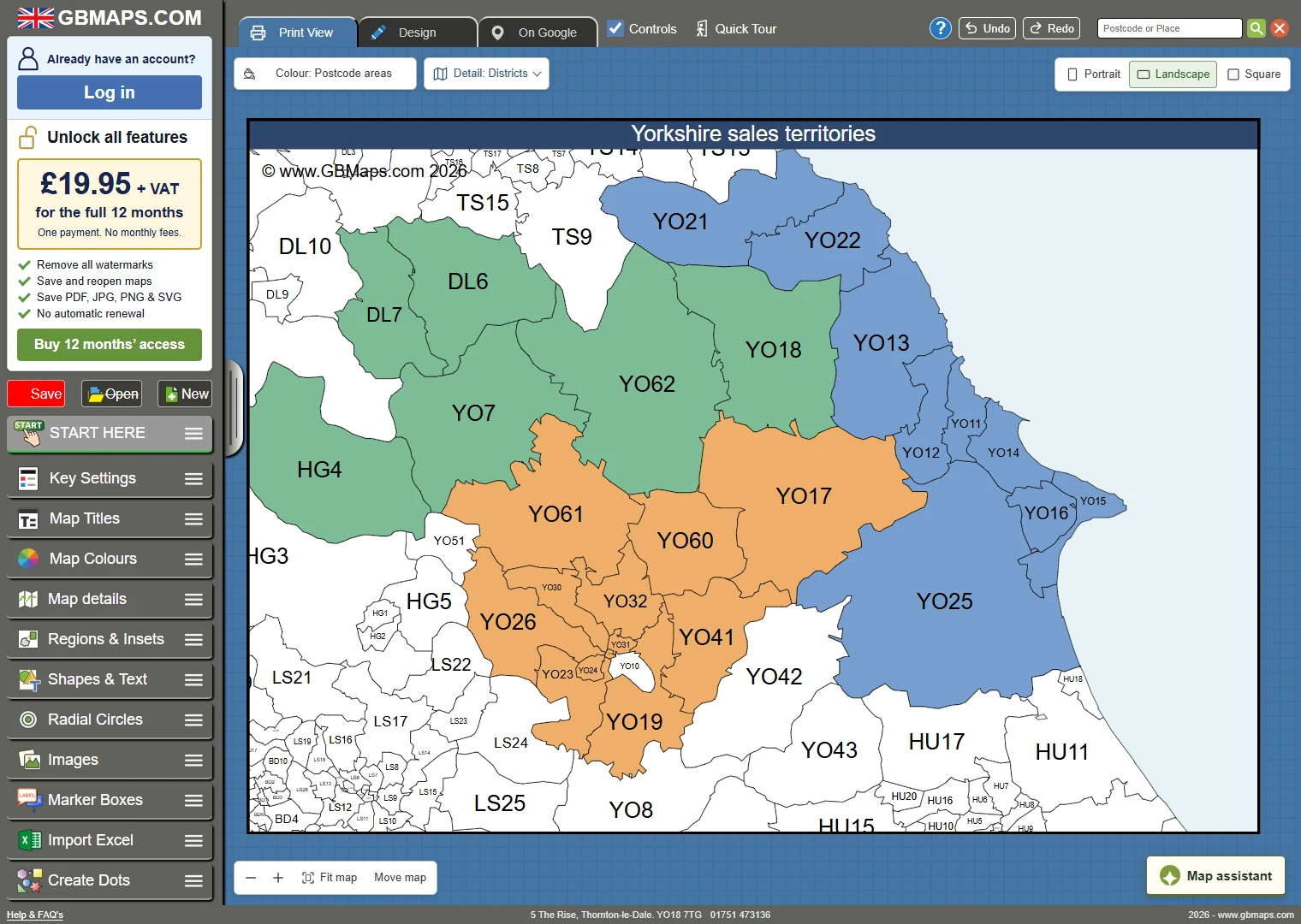
A map licence is needed to save and download. Prices are shown in the tool.
One payment for 12 months of map access.
No automatic renewal.
Questions about creating your map
Need help with your postcode list?
Call 01751 473136 or contact our map team.
What should my spreadsheet contain?
Use a header row, a postcode column and a territory column. For example, put YO18 in the postcode column and North team in the territory column. Use one postcode per row and the same name for all rows in a territory. The table above shows an example.
Which Excel file formats can I use?
You can upload .xlsx, .csv and .tsv files up to 6 MB and 5,000 rows. If you have an older .xls workbook, save a copy as .xlsx or CSV first.
What is the difference between areas, districts and sectors?
A postcode area, such as YO, covers a broad region. A district, such as YO18, gives more local detail. A sector, such as YO18 7, divides a district into smaller parts. A full postcode, such as YO18 7TG, is different from a sector. See our postcode guide for examples.
Can I change the map after it opens?
Yes. In the map tool, you can change colours, edit territory names, add text and images, and adjust the page layout. You can also change individual postcode areas and use Undo while you edit.
Do I need to pay to save or download my map?
You can try the map editor before you buy. Trial maps have a watermark. To save and download, you need an active licence for your chosen map type. The price is shown before payment. Map access lasts 12 months and does not renew automatically.
What can I download from the map tool?
With the right map licence, you can download PDF, SVG, PNG, JPG and PowerPoint files. You can also export territory data as CSV. Sign in to save an editable map that you can return to later.
Start with your postcode spreadsheet
Create a coloured map that you can edit in the GBMaps tool.