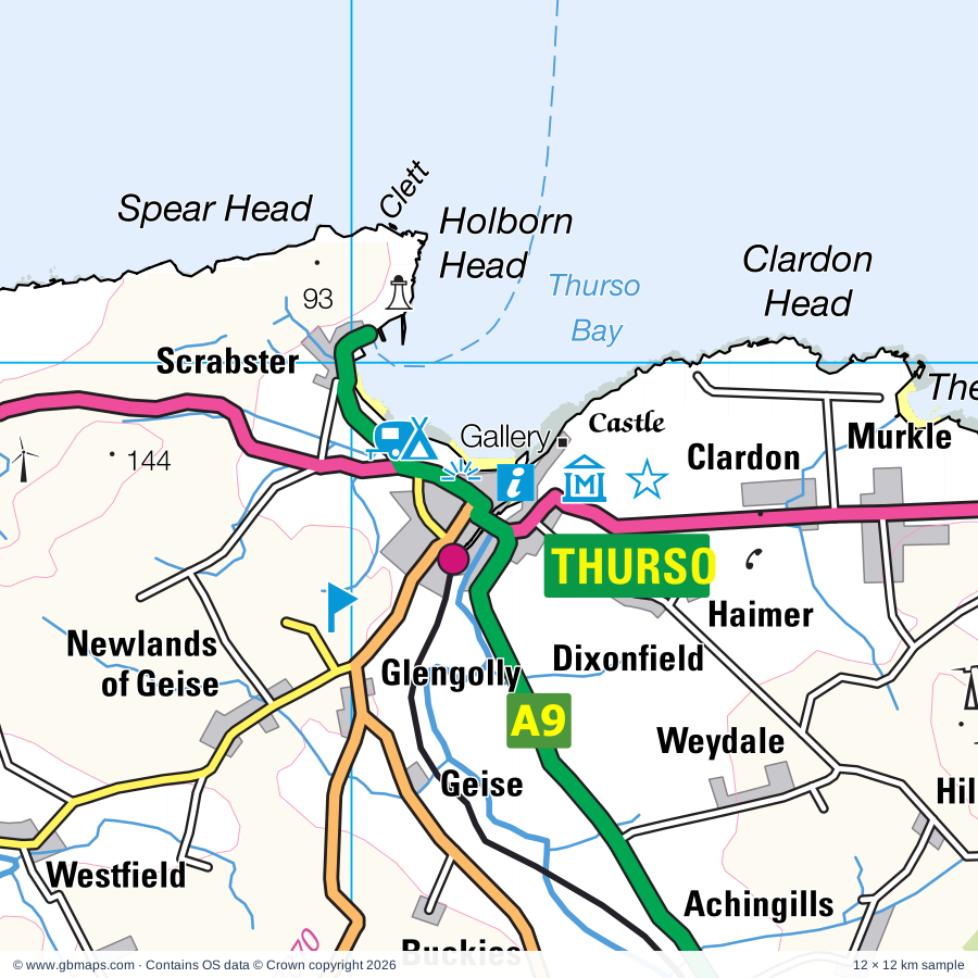
Explore the full 60 × 60 km Thurso regional road map at 1:250,000, covering Thurso, Shebster, Shurrery, Isauld, Reay. Compare the complete coverage below; a detailed PDF sample is available free.
Achairn Burn, Achvarasdal Burn, Allt Airigh-dhamh, Allt Forsiescye, Allt Lon a' Chuil, Allt na Cailbhe Mor, Armadale Burn, Bannock Burn, Berriedale Water, Burn of Acharole, Burn of Houstry, Burn of Lyth
More waterways
Camster Burn, Clachan Burn, Dunbeath Water, Feith Gaineimh Mhor, Forsinain Burn, Forss Water, Garbh-allt, Glutt Water, Halladale River, Kinbrace Burn, Kirk Burn, Little River, Reisgill Burn, Rimsdale Burn, River Dyke, River Helmsdale, River Naver, River Strathy, River Thurso, Rumsdale Water, Sandside Burn, Skelpick Burn, Sleach Water, Smigel Burn, Strath Burn, The Uair, Torran Water, Wick River
Castlehill Heritage Centre, Clan Gunn Heritage Centre, Cnoc Freiceadain Chambered Cairns, Dalnawillan Lodge, Dounreay Exhibition Centre, Swanson Gallery, Dunnet Links Visitor Centre, Forse House, Forsinard Nature Reserve, Garvault Hotel, Grey Cairns of Camster, Hill o' Many Stanes, Hotel, Laidhay Croft Museum, Latheronwheel House, Lochdhu, Lochmore Cottage, Lyth Arts Centre, Mary-Ann's Cottage, North Shore Pottery, Olrig House, Ross Institute, Sandside House, Shurrery Lodge, St Mary's Chapel, Stemster House, Strathmore Lodge, Strathy Point, Thurso Museum, Waterlines Heritage Centre
Wholly or partly within the full map rectangle. These boundaries are coverage information, not additional artwork layers.
HighlandPartly within
Orkney IslandsPartly within
Wards & electoral divisions 5 areas
East Sutherland and Edderton Ward (part)
North, West and Central Sutherland Ward (part)
Stromness and South Isles Ward (part)
Thurso and Northwest Caithness Ward (part)
Wick and East Caithness Ward (part)
Civil parishes & communities 0 areas
Source: the GBMaps road atlas, OS Boundary-Line and postcode mapping datasets. Source editions are being checked for publication. Unmarked boundary names are wholly within the sheet; “part” means the map edge crosses the area.
INSIDE YOUR DOWNLOAD
A proper road map, in useful formats
Road classifications, towns and villages, railways, rivers, landscape detail and tourist symbols, brought together in the GBMaps regional road atlas style.
PDF for the finished map. SVG and layered Illustrator artwork for adapting colours, adding your own information and preparing designs.
THE FINISHED SHEET
Designed for print and presentation
Map coverage
60 × 60 km
Sample coverage
12 × 12 km
Print layout
A3 landscape · enlarged 1:250k cartography
Sheet furniture
Border, scale bar, key & north arrow
A few useful details
What changes when I select another square?
Select a surrounding square to bring it into the centre and reveal the maps around it. Each square is a different 60 × 60 km map. The preview, free sample and selected download change together. Neighbouring sheets overlap by 30 km so you can choose the coverage that suits you.
Is the free sample a vector map?
The on-page detail is an SVG. The free download is a separate 12 × 12 km PDF with a link to the full map. Please retain its copyright credits and product link when sharing it.
Can I buy a larger combined map?
These downloads are individual ready-made sheets. Contact GBMaps if you need a larger combined area.