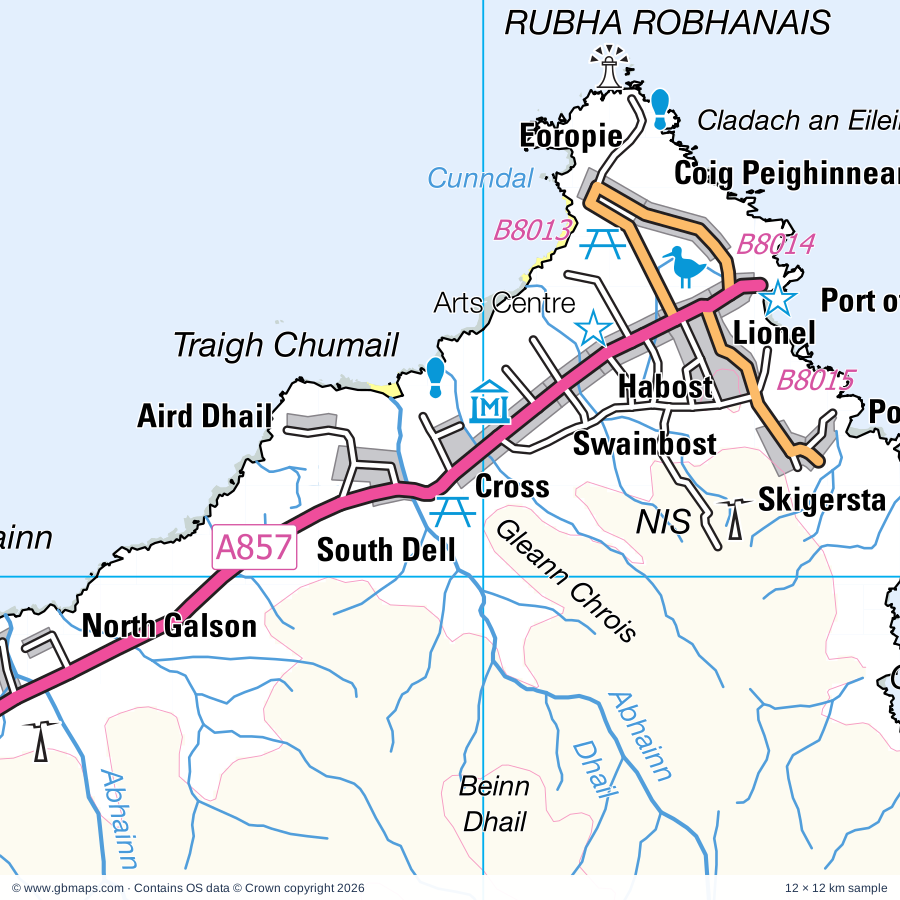
Explore the full 60 × 60 km North Dell regional road map at 1:250,000, covering South Dell, Cross, Swainbost, Habost, Skigersta. Compare the complete coverage below; a detailed PDF sample is available free.
An Lanntair Arts Centre, The Woodland Centre Visitor Centre, Arnol Black House, Arnol Blackhouse, Blue Pig Gallery, Borgh Pottery, Calanais Standing Stones, Visitor Centre, Clach an Truiseil, Cnoc Ceann a' Gharraidh, Cnoc Fhillibhir Bheag (Stone Circles), Harbour View Gallery, Hebridean Replicas, Lewis Castle, Lewis Castle Gardens
More named features
Lewis Loom Centre, Loch Stiapabhat Local Nature Reserve, Morven Gallery, Museum Nan Eilean, Ness Heritage Centre, Norse Mill and Kiln, Oiseval Gallery, Shawbost Folk Museum, Steinacleit, Stone Circle, Stones, Taigh Dhonnchaidh (Arts Centre), Whalebone Arch
Postcode maps covering this area
Postcode districts within the sheet
HS districts
HS1, HS2 (part)
Local authority & parish coverage
Wholly or partly within the full map rectangle. These boundaries are coverage information, not additional artwork layers.
Na h-Eileanan an IarPartly within
Wards & electoral divisions 7 areas
An Taobh Siar agus Nis Ward (part)
Loch a Tuath Ward
Sgir' Uige agus Carlabhagh Ward (part)
Sgire an Rubha Ward (part)
Sgire nan Loch Ward (part)
Steornabhagh a Deas Ward
Steornabhagh a Tuath Ward
Civil parishes & communities 0 areas
Source: the GBMaps road atlas, OS Boundary-Line and postcode mapping datasets. Source editions are being checked for publication. Unmarked boundary names are wholly within the sheet; “part” means the map edge crosses the area.
INSIDE YOUR DOWNLOAD
A proper road map, in useful formats
Road classifications, towns and villages, railways, rivers, landscape detail and tourist symbols, brought together in the GBMaps regional road atlas style.
PDF for the finished map. SVG and layered Illustrator artwork for adapting colours, adding your own information and preparing designs.
THE FINISHED SHEET
Designed for print and presentation
Map coverage
60 × 60 km
Sample coverage
12 × 12 km
Print layout
A3 landscape · enlarged 1:250k cartography
Sheet furniture
Border, scale bar, key & north arrow
A few useful details
What changes when I select another square?
Select a surrounding square to bring it into the centre and reveal the maps around it. Each square is a different 60 × 60 km map. The preview, free sample and selected download change together. Neighbouring sheets overlap by 30 km so you can choose the coverage that suits you.
Is the free sample a vector map?
The on-page detail is an SVG. The free download is a separate 12 × 12 km PDF with a link to the full map. Please retain its copyright credits and product link when sharing it.
Can I buy a larger combined map?
These downloads are individual ready-made sheets. Contact GBMaps if you need a larger combined area.