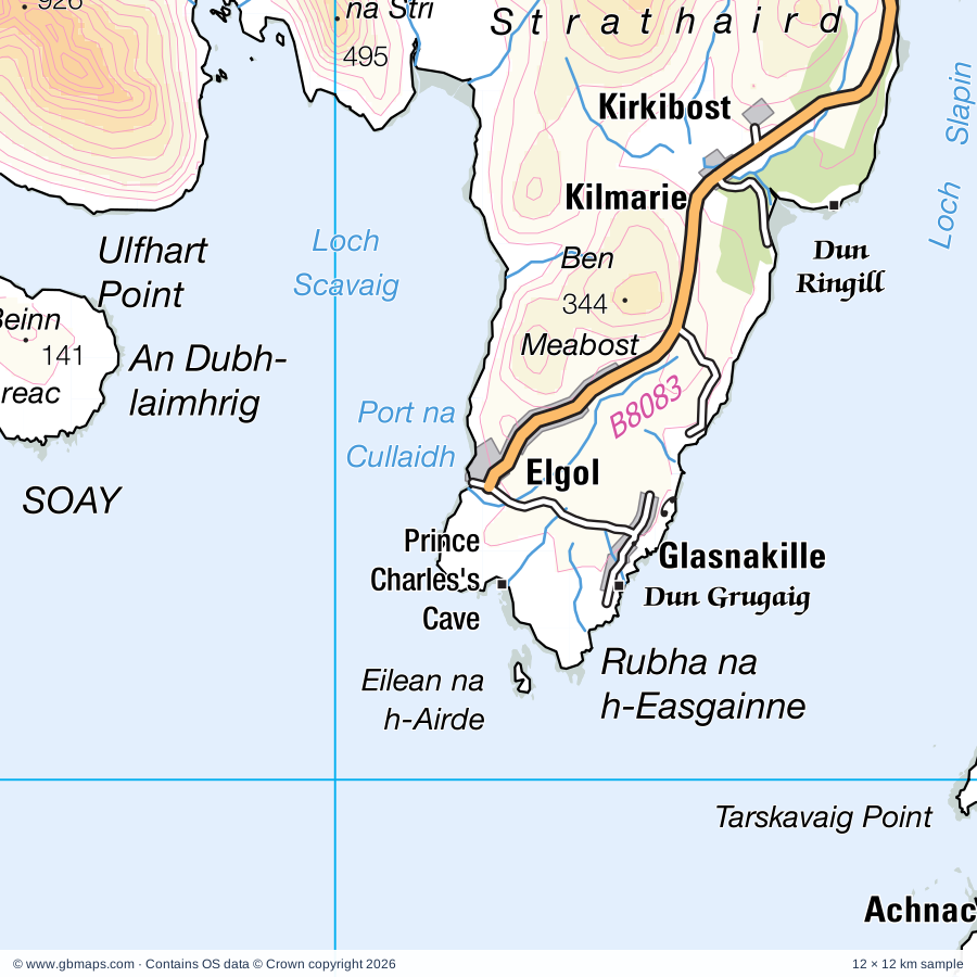
Explore the full 60 × 60 km Elgol regional road map at 1:250,000, covering Elgol, Glasnakille, Achnacloich, Kirkibost, Tokavaig. Compare the complete coverage below; a detailed PDF sample is available free.
Abhainn Lusa, Allt Mor, Borrodale Burn, Eynort River, Ord River, River Brittle, River Drynoch, River Meoble, River Sligachan, River Toscaig, Varragill River
Landmarks & landscape
Aird Old Church, Armadale Castle, Balmacarra Square Visitor Centre, Bay Pottery, Between-the-Lines Gallery, Broch, Cairn, Clan Donald Visitor Centre, Donald Murchison's Monument, Dun, Dun Beag Broch, Dun Grugaig
More named features
Dun Ringill, Dunsgiath Castle, Glenbrittle House, Glendrynoch Lodge, Isle of Eigg Craft Shop and Tearoom (Visitor Centre), Isleornsay Gallery, Gallery An Talla Dearg, Kinloch Castle, Knock Castle, Kyle Lochalsh Railway Station Museum, Kylerhea Otter Haven, Lochalsh House and Garden, Mallaig Heritage Centre, Museum of the Isles, Prince Charles's Cave, Rum National Nature Reserve, Scalpay House, Skye Serpentarium Reptile World, Sligachan Hotel, Talisker Distillery, Teo's Handspun, Skye Jewelery, The Blue Studio Gallery, The Prince's Cairn, Traigh House, Visitor Centre, West Highland Heavy Horses
Wholly or partly within the full map rectangle. These boundaries are coverage information, not additional artwork layers.
HighlandPartly within
Wards & electoral divisions 4 areas
Caol and Mallaig Ward (part)
Eilean a' Cheo Ward (part)
Fort William and Ardnamurchan Ward (part)
Wester Ross, Strathpeffer and Lochalsh Ward (part)
Civil parishes & communities 0 areas
Source: the GBMaps road atlas, OS Boundary-Line and postcode mapping datasets. Source editions are being checked for publication. Unmarked boundary names are wholly within the sheet; “part” means the map edge crosses the area.
INSIDE YOUR DOWNLOAD
A proper road map, in useful formats
Road classifications, towns and villages, railways, rivers, landscape detail and tourist symbols, brought together in the GBMaps regional road atlas style.
PDF for the finished map. SVG and layered Illustrator artwork for adapting colours, adding your own information and preparing designs.
THE FINISHED SHEET
Designed for print and presentation
Map coverage
60 × 60 km
Sample coverage
12 × 12 km
Print layout
A3 landscape · enlarged 1:250k cartography
Sheet furniture
Border, scale bar, key & north arrow
A few useful details
What changes when I select another square?
Select a surrounding square to bring it into the centre and reveal the maps around it. Each square is a different 60 × 60 km map. The preview, free sample and selected download change together. Neighbouring sheets overlap by 30 km so you can choose the coverage that suits you.
Is the free sample a vector map?
The on-page detail is an SVG. The free download is a separate 12 × 12 km PDF with a link to the full map. Please retain its copyright credits and product link when sharing it.
Can I buy a larger combined map?
These downloads are individual ready-made sheets. Contact GBMaps if you need a larger combined area.