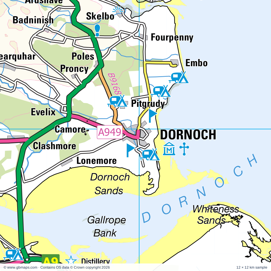
Explore the full 60 × 60 km Dornoch regional road map at 1:250,000, covering Dornoch, Tain, Pittentrail, Ardachu, Muie. Compare the complete coverage below; a detailed PDF sample is available free.
Abhainn Beinn nan Eun, Abhainn Sgeamhaidh, Abhainn Strath na Seilge, Abhainn a Ghlinne Mhoir, Abhainn an t-Srath Chuileannaich, Abhainn an t-Sratha Charnaig, Abhainn na Frithe, Abhainn na Glasa, Alladale River, Allt Ach' a' Bhathaich, Allt Car, Allt Chaiseagail
More waterways
Allt Garbh-airigh, Allt Smeaorail, Allt a' Bhunn, Allt a' Mhuilinn, Allt an Duin, Allt an Ealaidh, Allt nan Achaidhean, An Uidh, Black Water, Coirefrois Burn, Craggie Water, Diebidale River, Easter Fearn Burn, Feith a' Chaoruinn, Garvary Burn, Golspie Burn, Grudie Burn, Kildonan Burn, Kinbrace Burn, Kyle of Sutherland, River Averon or Alness River, River Brora, River Carron, River Cassley, River Evelix, River Fiag, River Fleet, River Glass, River Helmsdale, River Oykel, River Shin, River Skinsdale, River Tirry, Scottarie Burn, Suisgill Burn, Torbreck Burn, Tuarie Burn, Water of Glencalvie, Wester Fearn Burn
Wholly or partly within the full map rectangle. These boundaries are coverage information, not additional artwork layers.
HighlandPartly within
Wards & electoral divisions 5 areas
Cromarty Firth Ward (part)
East Sutherland and Edderton Ward (part)
North, West and Central Sutherland Ward (part)
Tain and Easter Ross Ward (part)
Wester Ross, Strathpeffer and Lochalsh Ward (part)
Civil parishes & communities 0 areas
Source: the GBMaps road atlas, OS Boundary-Line and postcode mapping datasets. Source editions are being checked for publication. Unmarked boundary names are wholly within the sheet; “part” means the map edge crosses the area.
INSIDE YOUR DOWNLOAD
A proper road map, in useful formats
Road classifications, towns and villages, railways, rivers, landscape detail and tourist symbols, brought together in the GBMaps regional road atlas style.
PDF for the finished map. SVG and layered Illustrator artwork for adapting colours, adding your own information and preparing designs.
THE FINISHED SHEET
Designed for print and presentation
Map coverage
60 × 60 km
Sample coverage
12 × 12 km
Print layout
A3 landscape · enlarged 1:250k cartography
Sheet furniture
Border, scale bar, key & north arrow
A few useful details
What changes when I select another square?
Select a surrounding square to bring it into the centre and reveal the maps around it. Each square is a different 60 × 60 km map. The preview, free sample and selected download change together. Neighbouring sheets overlap by 30 km so you can choose the coverage that suits you.
Is the free sample a vector map?
The on-page detail is an SVG. The free download is a separate 12 × 12 km PDF with a link to the full map. Please retain its copyright credits and product link when sharing it.
Can I buy a larger combined map?
These downloads are individual ready-made sheets. Contact GBMaps if you need a larger combined area.