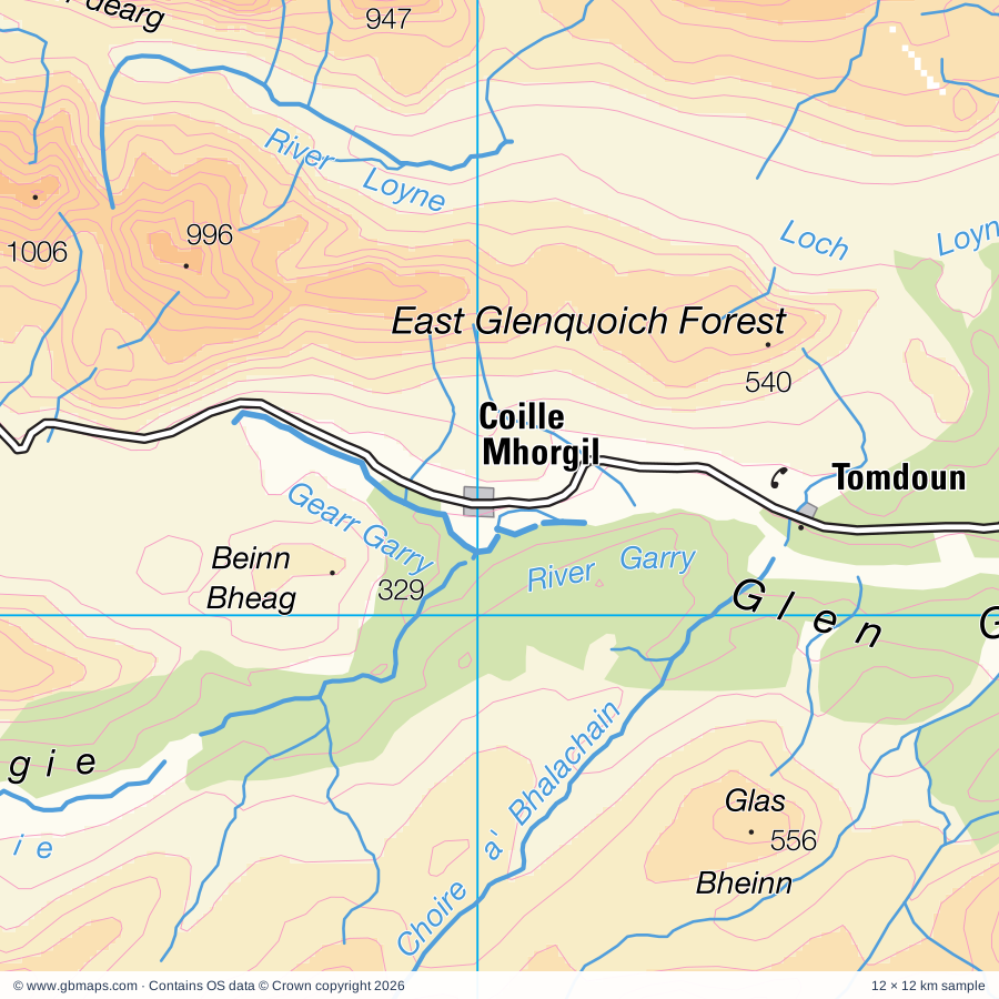
Explore the full 60 × 60 km Coille Mhorgil regional road map at 1:250,000, covering Tomdoun, Inchlaggan, Kinloch Hourn, Morvich, Carn-gorm. Compare the complete coverage below; a detailed PDF sample is available free.
Abhainn Chosaidh, Abhainn Deabhag, Abhainn Sithidh, Abhainn a Choilich, Abhainn a' Ghlinne Bhig, Aldernaig Burn, Allt Bhlaraidh, Allt Camgharaidh, Allt Choire a' Bhalachain, Allt Garbh, Allt Glas Dhoire, Allt Gleann Udalain
More waterways
Allt Laire, Allt Loraich, Allt Lundie, Allt Phocaichain, Allt Riabhach, Allt a' Chaorainn, Allt na Doire Garbhe, Allt na Muic, An t-Suileag, Burn of Agie, Calder Burn, Caledonian Canal, Callop River, Dubh Lighe, Fionn Lighe, Garbh-uisge, Gearr Garry, Glenmore River, Neaty Burn, River Affric, River Attadale, River Barrisdale, River Cannich, River Dessarry, River Doe, River Elchaig, River Enrick, River Farrar, River Finnan, River Garry, River Glass, River Gloy, River Kingie, River Ling, River Lochy, River Loy, River Loyne, River Mallie, River Meoble, River Moriston, River Oich, River Pean, River Roy, River Shiel, River Spean, River Tarff, River Turret, The Cour, Uisge Misgeach
Landmarks & landscape
Aberchalder Lodge, Ardochy House, Attadale Gardens, Bendronaig Lodge, Bray Roy Lodge, Bridge of Oich, Broch, Caledonian Canal Visitor Centre, Candle Workshop, Clan Cameron Museum, Cluanie Inn, Cluanie Lodge
More named features
Commando Exhibition, Commando Memorial, Corrimony Chambered Cairn, Cougie Lodge, Craig Highland Farm, Croft Museum, Daingean Settlement, Dog Falls, Dun Grugaig, Dun Telve, Dun Telve, Dun Troddan, Dun Troddan, Dundreggan Lodge, Eilean Donan Castle, Falls of Glomach, Fasnakyle House, Glen Affric Caledonian Forest Reserve, Glen Roy National Nature Reserve, Glenfinnan Monument, Glenfinnan Museum, Glenfinnan Visitor Centre, Great Glen Water Park, Highland Origins, Inchnacardoch Lodge Hotel, Invergloy House, Lochcarron Weavers, Mullardoch House, Nature Reserve, Plodda Falls, Spean Bridge Mill, Strome Castle, The Clansman Centre, Visitor Centre
Wholly or partly within the full map rectangle. These boundaries are coverage information, not additional artwork layers.
HighlandPartly within
Wards & electoral divisions 5 areas
Aird and Loch Ness Ward (part)
Caol and Mallaig Ward (part)
Eilean a' Cheo Ward (part)
Fort William and Ardnamurchan Ward (part)
Wester Ross, Strathpeffer and Lochalsh Ward (part)
Civil parishes & communities 0 areas
Source: the GBMaps road atlas, OS Boundary-Line and postcode mapping datasets. Source editions are being checked for publication. Unmarked boundary names are wholly within the sheet; “part” means the map edge crosses the area.
INSIDE YOUR DOWNLOAD
A proper road map, in useful formats
Road classifications, towns and villages, railways, rivers, landscape detail and tourist symbols, brought together in the GBMaps regional road atlas style.
PDF for the finished map. SVG and layered Illustrator artwork for adapting colours, adding your own information and preparing designs.
THE FINISHED SHEET
Designed for print and presentation
Map coverage
60 × 60 km
Sample coverage
12 × 12 km
Print layout
A3 landscape · enlarged 1:250k cartography
Sheet furniture
Border, scale bar, key & north arrow
A few useful details
What changes when I select another square?
Select a surrounding square to bring it into the centre and reveal the maps around it. Each square is a different 60 × 60 km map. The preview, free sample and selected download change together. Neighbouring sheets overlap by 30 km so you can choose the coverage that suits you.
Is the free sample a vector map?
The on-page detail is an SVG. The free download is a separate 12 × 12 km PDF with a link to the full map. Please retain its copyright credits and product link when sharing it.
Can I buy a larger combined map?
These downloads are individual ready-made sheets. Contact GBMaps if you need a larger combined area.