Additional Data Thumbnail Radial Circles Thumbnail Map Colours Thumbnail Import Dots Thumbnail Import Excel Thumbnail Drivetime Isochrones Thumbnail Map Legend Thumbnail Add Marker Boxes Thumbnail Save Map Thumbnail Visibility Thumbnail Map Titles Thumbnail Adding Map Zones Thumbnail

Have a read before you commit to buying an unlock..

Unlock your NHS ICS LAD Boundaries Map

£32.45 + VAT
12 months’ full accessOne payment
  • Instant access with card or PayPal
  • No automatic renewal

Pay by card

Secure checkout with Worldpay

Card and PayPal payments are handled securely by Worldpay or PayPal.

Buying FAQs

What is included?

12 months’ full access, including feature updates. One payment, with no automatic renewal.

  • Create and customise as many NHS ICS LAD Boundaries Map maps as you need.
  • Save, reopen and edit your maps as often as you need.
  • Import Excel data to colour territories and place circles or dots.
  • Download your maps in PDF, SVG, PNG and Excel formats.
  • Share your maps over a Google-style map.
  • Add distance rings for delivery zones and drive-time polygons (isochrones).

How many people can use the licence?

Each person using the software needs their own licence.

1 user licence
gbmaps logo and union jack
GBMAPS.COM
Unlock all features
£32.45 + VAT
for the full 12 months
One payment. No monthly fees.
  • Remove all watermarks
  • Save and reopen maps
  • Save PDF, JPG, PNG & SVG
  • No automatic renewal
Save
Open
Open
New

Save your map

Download your map

SVG Loading Progress Bar spinny loading wheel

START HERE

Legend Names

Key Settings

Key layout

Map Titles

Map Colours

Map & title

Labels

Boundaries

Map details

Shapes & Text

Add a shape or note, draw your own boundary, or highlight a map area.

From a map area

Available to try before you buy.

Radial Circles

Position

Click the map to set the centre.

Circles

1
3

Colours & labels

Images

Add a logo, photograph or illustration. Keep each image on the page, or let it move with the map.

Drop your images herePNG, JPEG or WebP · up to 3 MB each

Up to five images. Try it before you buy.

Marker Boxes

Your markers

0 markers

Add a marker to get started.

Tick, then click the map to position it.

Appearance

Text colourblack
Outline colourblack
5
Call-out settings
5
Import from postcodes
0 entries
0 entries

One postcode and matching label per line.

Import Excel

Paste your data

Paste matching columns from Excel.

No rows yet

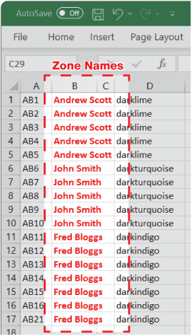
One postcode per row. Leave zone names blank to use Zone 1.

Colours

Use your own colour column.

Sample data

Selecting a sample imports it to the map.

Legend details

Add contact details or notes beneath each name.

For the extra detail lines in every entry.

One item per line. Blank lines are ignored. Up to 20 lines.

Preview

Statistics stay controlled by Additional Data. Long lines wrap automatically.

Paste details from Excel

Copy a table with one row per legend entry. The first column matches a name already on your map.

Legend name Line 1Line 2Line 3…

A postcode in these details is just text; it does not colour an area on the map.

Save your map afterwards to keep these changes.

Create Dots

Postcodes

One postcode per line

0 entries

Size & appearance

1
  • Line colour
  • Fill colour
More appearance options
50%
50%

Distance/Time

1 · Start from

2 · How far

3 · Legend

Heat Maps

Colour map areas by their values. See where sales are strongest, or compare your figures at a glance.

More options

Only use percentages already calculated for these map areas. Adding percentages from smaller areas does not give a valid total.

Previewing these ranges leaves your map alone. Creating the heat map changes its territory colours; Undo restores them.

Additional Data

Add your sales, customers or other figures. Colour territories as usual and see their totals in the legend.

Load included statistics

More Maps

Search both mapping tools

Open in VectorMaps?

This map opens in our newer mapping tool on another website.

pro
vectormaps.uk

Save any changes before leaving this page.

Open map
Opening the handbook…
Advanced Multiple Isochrones Import.
?
Colour: Postcode areas
Zoom Out Zoom In
pancentre hand icon
Reset Zoom
Portrait map Active Landscape map Active Square map Active
Trial Software www.gbmaps.com Armagh City, Banbridge and Craigavon Bournemouth, Christchurch and Poole Hammersmith and Fulham North Northamptonshire West Northamptonshire Causeway Coast and Glens Rhondda Cynon Taf Basingstoke and Deane South Gloucestershire Newcastle upon Tyne South Cambridgeshire East Cambridgeshire East Dunbartonshire Richmond upon Thames King's Lynn and West Norfolk Fermanagh and Omagh West Dunbartonshire Antrim and Newtownabbey Newry, Mourne and Down Folkestone and Hythe Kensington and Chelsea Somerset West and Taunton Ards and North Down Cheshire West and Chester North West Leicestershire Herefordshire, County of Bath and North East Somerset Blackburn with Darwen Derry City and Strabane Kingston upon Thames Na h-Eileanan Siar Na h-Eileanan Siar Na h-Eileanan Siar Na h-Eileanan Siar Nuneaton and Bedworth North Warwickshire Na h-Eileanan Siar Kingston upon Hull, City of Na h-Eileanan Siar Tonbridge and Malling East Renfrewshire North Hertfordshire Hinckley and Bosworth East Hertfordshire Dumfries and Galloway East Riding of Yorkshire Windsor and Maidenhead Central Bedfordshire North East Lincolnshire North Lincolnshire North Lanarkshire Brighton and Hove Lisburn and Castlereagh South Lanarkshire Newark and Sherwood Staffordshire Moorlands South Staffordshire East Staffordshire Mid and East Antrim Vale of White Horse Newcastle-under-Lyme Reigate and Banstead South Oxfordshire West Oxfordshire Barking and Dagenham Redcar and Cleveland South Derbyshire Derbyshire Dales North East Derbyshire Vale of Glamorgan Oadby and Wigston Bristol, City of Telford and Wrekin Neath Port Talbot City of Edinburgh Clackmannanshire Barrow-in-Furness Isle of Anglesey Perth and Kinross Bracknell Forest Southend-on-Sea Stratford-on-Avon Buckinghamshire Stockton-on-Tees Shetland Islands West Lancashire Carmarthenshire Huntingdonshire Epsom and Ewell Cannock Chase Northumberland Tunbridge Wells Scottish Borders East Hampshire County Durham Wolverhampton Welwyn Hatfield Waltham Forest Monmouthshire Pembrokeshire North Tyneside North Somerset South Somerset Richmondshire South Tyneside West Berkshire South Lakeland Great Yarmouth Orkney Islands North Kesteven South Kesteven Blaenau Gwent Middlesbrough Stoke-on-Trent Aberdeenshire Argyll and Bute North Ayrshire Argyll and Bute South Ayrshire Forest of Dean Argyll and Bute Argyll and Bute Argyll and Bute Argyll and Bute North Ayrshire Argyll and Bute Tower Hamlets Argyll and Bute Argyll and Bute Argyll and Bute City of London Aberdeen City Cheshire East Epping Forest Milton Keynes Renfrewshire South Holland Peterborough West Lindsey Denbighshire Three Rivers East Ayrshire North Norfolk Merthyr Tydfil Surrey Heath South Norfolk Scarborough Glasgow City North Devon Amber Valley Malvern Hills Ribble Valley Southampton Wandsworth East Lindsey West Lothian Westminster Tewkesbury Rossendale South Ribble Harborough West Devon Runnymede Bromsgrove Wyre Forest Dundee City Gravesham West Suffolk Broxbourne Wokingham Cheltenham South Hams Charnwood East Lothian Manchester Chesterfield Sevenoaks Castle Point Chelmsford Birmingham New Forest Teignbridge Canterbury Winchester Sunderland East Devon Isle of Wight Eastbourne Sedgemoor Mid Sussex Greenwich Wychavon East Suffolk Rotherham Colchester Warrington Ceredigion Nottingham Gloucester Portsmouth Calderdale Mole Valley Gateshead Shropshire Cambridge Chichester Worcester Mid Devon Stevenage Hertsmere Spelthorne Southwark Brentwood Doncaster Rushmoor Redbridge Inverclyde Hambleton Lancaster Bassetlaw Hyndburn Maidstone Lewisham Broadland Test Valley Mid Suffolk Breckland Darlington High Peak Hartlepool Hounslow Harrogate Caerphilly St. Helens Blackpool Rochdale Elmbridge Rushcliffe Hillingdon Copeland Mid Ulster Waverley Midlothian Wakefield Tandridge Wrexham Gwynedd Knowsley Broxtowe Mansfield Horsham Liverpool Coventry Haringey Uttlesford Tamworth Leicester Cotswold Swansea Rochford Hackney Havering Thurrock Dacorum Tameside Stockport Plymouth Cherwell Sandwell Flintshire Bridgend Guildford Newham Barnsley Braintree Highland Highland Highland Highland Wealden Croydon Hastings Highland Highland St Albans Redditch Fareham Erewash Worthing Bolsover Eastleigh Cornwall Warwick Swindon Bradford Basildon Camden Medway Wiltshire Norwich Crawley Allerdale Lambeth Ryedale Tendring Reading Babergh Newport Sheffield Gosport Fenland Dartford Chorley Kirklees Torridge Bromley Lichfield Islington Watford Ashfield Bedford Rutland Burnley Ashford Oldham Trafford Gedling Ipswich Preston Carlisle Craven Woking Harrow Walsall Conwy Harlow Maldon Havant Lincoln Torfaen Stafford Mendip Dudley Merton Rugby Rother Lewes Oxford Pendle Boston Bexley Powys Thanet Slough Falkirk Dorset Torbay Salford Solihull Belfast Stirling Dover Halton Barnet Leeds Derby Stroud Wigan Enfield Angus Moray Exeter Cardiff Melton Sefton Swale Bolton Wirral Ealing Sutton Blaby Wyre Fylde Luton Selby Eden Brent Arun Adur Bury York Hart Fife Durham Darlington Teesside Hambleton Richmondshire and Whitby Northumberl and Tyne and Wear and North Durham Bristol North Somerset and South Gloucestershire Leicester Leicestershire and Rutland Buckinghamshire Oxfordshire and Berkshire West Aneurin Bevan University Health Board Betsi Cadwaladr University Health Board Milton Keynes Bedfordshire and Luton Betsi Cadwaladr University Health Board Cardiff and Vale University Health Board Lancashire and South Cumbria Greater Glasgow and Clyde Hywel Dda University Health Board West North and East Cumbria South Yorkshire and Bassetlaw Cambridgeshire and Peterborough Northern Health and Swanse Bay Health Board Cwm Taf University Health Board Hampshire and the Isle of Wight Shropshire and Telford and Wrekin Humber and North Yorkshire Bath Swindon and Wiltshire Herefordshire and Worcestershire Hertfordshire and WestEssex Cornwall and the Isles of Scilly Sussex and East Surrey Birmingham and Solihull Powys Teaching Health Board Suffolk and NorthEastEssex Hampshire and theIsle of Wight Coventry and Warwickshire Dumfries and Galloway Cheshire and Merseyside Mid and South Essex Norfolk and Waveney North Central London Greater Manchester South West London South East London Ayrshire and Arran Ayrshire and Arran North West London North East London Surrey Heartlands The Black Country Kent and Medway Northamptonshire Shetland Islands Nottinghamshire Gloucestershire West Yorkshire Frimley Health Frimley Health Western Isles Western Isles Western Isles Western Isles Western Isles Western Isles Staffordshire Lincolnshire Lanarkshire ForthValley Derbyshire Grampian Somerset Highland Highland Highland Highland Highland Highland Highland Highland Highland Highland Highland Highland Highland Highland Borders Lothian Tayside Orkney Dorset Devon Fife South Eastern Health and Social Care Trust Southern Health and Social Care Trust Social Care Trust Western Health and Social CareTrust Belfast Health and Social Care Trust nhsICS district Map Heading 6.7 miles 13.4 miles20 miles © www.GBMaps.com 2026
USA 5-digit ZIP maps

Build a multi-state map

Choose up to 3 touching states. Alaska may be added separately. Load and customise your map before buying.

Select a state on the map. Select it again to remove it.